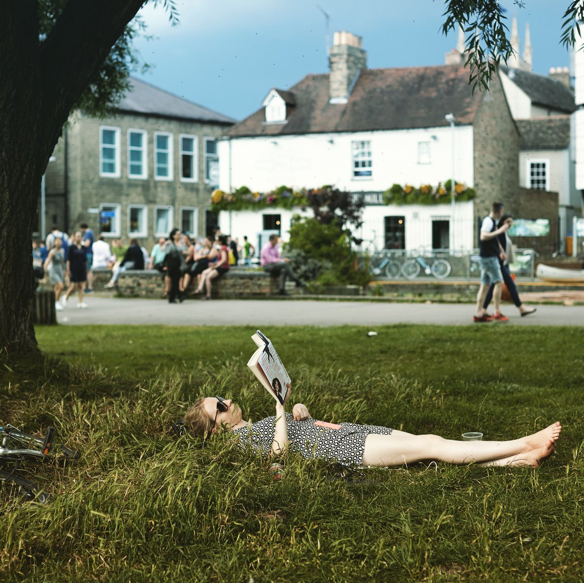
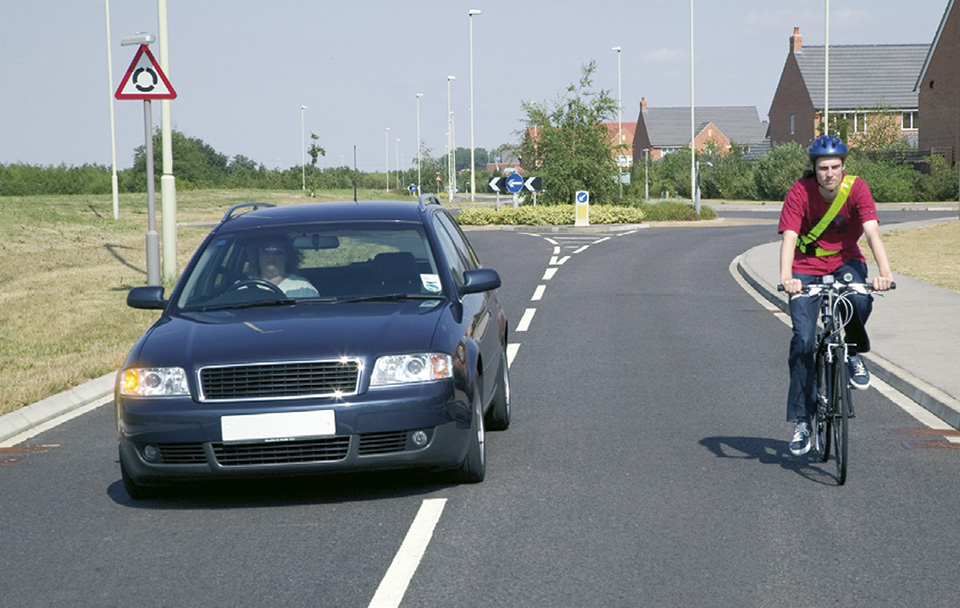
So @TheTimTraveller has challenged people over the world to take part in a "Mediocre Mountain Challenge". This seems to fit in perfectly with Cambridge, so let's do it for #CamRideHome!
So, you can choose your highest place and do a selfie or bike shot (or both) of you there with a description.
Or follow the meanderings I had to make to find Cambridge's highest point (or just jump to the end). I'd really like us to do lots of pictures at Cambridge's highest point but I leave it up to you!
So, what is the highest place in Cambridge? That should be easy I hear you say. Nope. Not a bit of it.
Where is Cambridge
We'll start with "Where is Cambridge?". Easy really, it's that city in East Anglia on the kink in the river Cam. Well, it is, but where are the boundaries?
Let's look at the parlimentary constituency borders (in red). The highest point is the south-east point on the Gog-Magog hills up Worsted St (or Worts Causeway). That's obvious and it's a lovely place. However, it's surrounded by fields with a good view of the city. It's not really "in" the city. On top of which, the nearby houses in view are NOT in the constituency. This really does make me feel like this isn't the place.
No, I think we need to look at what "feels" like the city (in blue). I don't think Grantchester should be included, or more importantly, the road over Lime Kiln Hill. Trumpington, Orchard Park, and Girton, yes. This is very subjective, I know, I just can't see how else to do it sensibly. And it's the latter location that provides our next dilemma.
Highest Place?
So, it's simple, look at the map and find the highest place. Well, not quite. Which map? Surely, they all agree. Nope. I looked at two that I trust the most, and they don't agree.
Looking at the Ordnance Survey map, they have a few places around Girton peaking at an enormous 25 metres. However, looking at the Topological map, they have a DIFFERENT place topping out at 30 metres. And both maps do NOT agree with each others points.
The highest point is either on Huntingdon Road directly outside Girton College or on the Ridgeway track to Eddington where it crosses the north-south access to the university farm.
So, I did a barometric altitude check by cycling between the two places. I know it's not accurate, but it shouldn't vary by much in a few minutes. The results favour the Ridgeway track, but only just. I think it fair to say, I still don't know.
So, What's the Challenge?
Go to either you're highest local location. Or go to Girton and take pictures at either Girton College Gate, or the Eddington Ridgeway track, or both as they are 5 minutes apart.
Take a selfie, bike photo, or both, and send them in on the #CamRideHome hashtag.
Again, lots of people grab hold of their bikes and ride out to Reach to see the 800 year old fair. It's around 14.5 miles in length, but that's not the thing people take away from this ride. What is the big thing is cycling with so many others enjoying the chat as we go along.
I had so many conversations with people I knew and people I'd never met before and may not meet again. Some people I'd recognise from previous years, and they'd always be new people coming with joyful ideas and positive involvement with riding.
Here's the route, with the main route in red and my short cut home in blue. Note that the shortcut home isn't possible as the busy road through Stow-cum-Quy is not passable by our larger group with a wider range of abilities.
It really is worth opening this up larger in a separate window.
So this year's video is a combination of the view forward and the reverse "faces" view. I do like ot see where we are going and it brings people in seeing what's about to happen in the facecam, possibly making it easier to spot yourself!
Here's the video of the route. Look out, music! (Go HD see * below)
00:11 Starting from The Guildhall
00:30 And onto Sidney Street
01:30 Explaining the TdF bunting
01:45 The first jam
02:30 A patient and happy taxi driver!
02:45 Zooming along at 8mph on Jesus Green
03:45 Camera fail!
05:00 Further jams at Cutter Ferr Bridge
07:00 Getting up to the front in a record distance
07:40 New path approach to Fen Ditton Lane
08:00 Loosing the leader's flag
08:45 Stopping in Bottisham
09:35 Final big pedal in a group to Lode
11:10 Reaching Reach!
“Cycling on the E-bike resulted in lower trip duration and exercise intensity, compared with the conventional bicycle. However, most of the time was spent in MVPA*. This suggests that changing the commuting mode from car to E-bike will significantly increase levels of physical activity while commuting.” (* Moderate to Vigorous Physical Activity)
One thing that can be said is that it's not a good for fitness as riding a normal bike. However, what happens when you don't feel capable of riding a normal bike in your local neighbourhood? This is what happened to my parents as they got toward the end of their 70s. The short hills and inclines in their area just made getting on the bike just too much. So, they would naturally go back to driving a car. And they did, and didn't as will follow.
Another study (which I've seen but have lost the link, damn it!) talks about how eBikes help soften the heartrate changes. When we go uphill, we exert more and our heartrate goes up.When we go downhill the reverse happens. With an eBike, this change in heartrate is flattened out. This is ideal for older people who need to exercise still, but the higher heartrates of going uphill put more stress on them than is healthy.
So, Ladies and Gentlemen, here's me with my mother on a 14-mile ride around their local neighbourhood. This simply wouldn't happen without the eBike. Look at the amount of pedalling happening. Without that the bike just doesn't go. This was well over an hour of moderate exercise that wouldn't happen without the eBike.
Here's the video of the route. Look out, music! (Go HD see * below)
0:11 Starting from Wenhaston, near The Star
0:28 Ah, uphill
1:02 Flat riding
1:28 Another incline
1:45 Into Darsham
2:45 Smaller inclines towards the end
3:30 Last incline, I can't keep up!
So, lots of populist opinion can be split on he "it's cheating" meme. And lots of purists can take about how riding a "proper" bike is better. But neither of them cater for my parents, so I'm not interested.
So with a lot of the development in Great Keighton and Trumpington Meadows getting closer to completion, how about a little look around to see what it's like cycling (and walking) around these places.
Here's the route, with the main route in blue and cut-throughs marked with sissors. There are a couple of exploratory routes and an idea for a fantastic linking route on the East bank of the Cam. It really is worth opening this up larger in a separate window.
Lots of good traffic concepts with these developments.
First, all the sides roads are narrow, winding, and have only a small amount of parking spaces. This slows all vehicles down and ensures not many will be coming in anyway. An interesting caveat to this is the main junction into Kneighton, a huge multi-lane affair with traffic lights. And it's hardly used. For some reason the developers simply couldn't get their head around that lack of vehicle transport mixing here.
Also, there are a lot of cut-throughs for people walking and cycling. Specically ways that make journeys like this shorter and more convenient. There were a few niggly bits, but mostly pretty good.
We did stop to look at the new cycle racks in the Trumpington Park & Ride. This does look like a big step backwards. Poor access, fewer racks, and all to add in a few more parking spaces.
Finally finishing at The Blue Ball in Grantchester for a chat and a beer.
Just for comparison, here's a local link to the National Library of Scotland maps from the late 1940s to 60s.
Here's the video of the route. Look out, music! (Go HD see * below)
0:11 Starting from The Mill
0:24 Lathams Lane, a nice new surface
0:57 Accessing Hobsons Conduit Path via uni road
1:09 Hobsons Conduit Path, lots of care and slow speeds
1:36 Stopping on the start of Vicars Brook
2:11 Builders access directly opposite, should have been opened up by now?
2:24 First cut into Great Kneighton, but gravel?
2:33 Narrow winding streets to slow vehicles
3:08 Dual-use "segregated" path outside (secondary) school
3:32 Onto the original public bridleway from Addenbrookes
4:27 Crossing the Guided Busway and on towards Shelford Road
5:15 Cut-trough from new to old developments
5:37 Up Bishops Road to last Great Kneighton cut-through
6:11 Poor barriers forcing active travellers into conflict without slowing vehicles
6:28 Loking at the new poor P&R bike racks
6:50 Out the back of the P&R and into Trumpington Meadows with lots of cut-throughs
7:34 Turning down onto the Meadows themselves
8:00 Heading onto The Ball Blue in Grantchester
Finally we get a pleasant, sunny, evening ride after a wet couple. So, what better than to look to the sun and the south city Trumpington Meadows Country Park?
The start point, as always, is from from The Mill by the river in the centre of town.
A short meander around west Cambridge, with the sun dripping off the tops of the hedges and verdant trees, but constantly heading towards Grantchester. Getting out of the city feels great on this lackadaisical Friday early evening, even cars are a rare and hardly noticed event.
Once through the beautiful Grantchester and across the river valley, the turn ito the route to Byron's Pool was welcome. We decided to drop the bikes (quite hard!) and walk down to the pool. Discovering ducks and the fish route round the weir was a little special.
So then off across Trumpington Meadows Country Park. It was just lovely. And clearly not well known about. When I had a look for any online activity about it I could only find rather awkward PDF history, and the local residents association run down which, whilst enabling lots of images, could really do with someone with website design experience (a bit like I might need to!).
So, it's great for people to walk and ride for a place to go. In some sense, it also could be used as a route through for people cycling from Harston and beyond into the city centre. Staying away from the awful road from the M11 to Trumpington High Street would be great. This could be the beginning of a green route in just like the other end of the river going out across Ditton Meadows. Of course it needs to be done right, but that should be easy with the space that's here.
On the way back we had a look at the new Clay Farm developments near the Guided Busway. It's great to see a new community centre appear, I hope it's well used.
We did wander up Limes Avenue and were quite disappointed. For a new development with so much space, why no dedicated cycle infrastructure? This would have been so easy to do, but there's absolutely nothing. On top of that, the development sticks to 1970s design models by making lots of straight roads, encouraging speeding by drivers. Again, and I know there are other issues, why not look at Cambourne? A place where few people drive faster than 20mph because it's too hard to go faster. Just like Eddington we seemed to have gone backwards. And this is a town where you'd have thought they would be thinking about these kind of things. But no. A poor development, infrastructure wise.
Here's the video of the route. Look out, music! (Go HD see * below)
0:11 Starting from The Mill
0:43 The road to Grantchester
1:01 The Blue Ball
1:14 The Green Man
1:37 Heading for Byrons Pool
2:03 Entering Trumpington Meadows Country Park 2:25 The Lark Sculpture
2:36 The Hare Sculpture
2:48 Pool
3:42 Harston cycle route
3:53 Clay Farm Centre
4:14 Limes Avenue
4:45 Returning to The Mill for a pint and a natter
After a really rather damp day, the ida of going out for a social ride seemed a bit too much. However, the experience was very different. There's something about doing things in a group that makes fun and worthwhile, despite the potentially inclement weather. In fact the adversity may actually bring about more pleasure as you seek to beat it as a group.
The start point, as always, is from from The Mill by the river in the centre of town.
And here's the video of the route. Look out, music! And inspired by the water all around us, a little ditty by New Model Army. (Go HD see * below)
0:11 Starting from The Mill
0:30 Passing Kings College
0:44 By the river on Jesus Green
1:22 Green Dragon Bridge
1:33 Fen Road Cyclepath
1:41 Snack break on the Guided Busway
1:59 Getting to the Arbury Road Cyclepath
2:30 Returning to The Mill for a pint and a natter
A slightly sad part was coming back down Mere and Carlton Way, although it didn't spoil the evening mood generally. Several close passes as people driving risked (us) getting round us on a narrow road with oncoming traffic.
One particular fine example of driving was someone passing us close at high speed and parking up in a bus stop. Reviewing video frames against nearby street items and measuring on satellite images showed they were doing at least 37mph (in a 20mph limit). Large car being driven well over the speed limit
So, the delights of early spring in Cambridge when the sun comes out. This ride has lots of cycle paths, quiet streets, open spaces, very pleasant in the early spring sun. Even the speeding close cars on Gilbert Road didn't spoil the mood. Every interaction other than that was with a smile, drivers included!
The start point is from Hills Road near the railway bridge, heading down Brooklands Avnue.
And here's the video of the route. Look out, soundtrack!(Go HD see * below)
0:11 Starting from Hills Road near the Railway Bridge
0:27 Crossing into the Coe Fen
0:41 Over the river
1:06 Cutting through the colleges to Burrells Walk
1:44 Up Madingley Road
2:00 Through the back of hte Astronomy
2:26 Crossing Huntingdon Road
2:51 Gilbert Road, speeding close cars, uggh
3:30 Over Fort St Goerge Bridge onto Midsummer Common
3:50 Keirin anyone?
4:05 Stourbridge Common with picnics
5:00 Onto Coldhams Common
5:36 Sedgwick Street with it's new counter flow cycle arrows
8:00 Railway Cycle Bridge
So a few decided to make the trip up to the new cycleroute that has been set up between Stow-cum-Quy and Lode. This was changed from a Friday evening to a Sunday lunchtime ride as it was New Years Eve (and few could do the Friday slot!). It had the benefit of ending at The Shed, a new pub in Lode, just about lunchtime. Hey Ho!
Setting Off (photo by Simon Nuttall)
Here's the route planned. A fairly simple jaunt along NCN51 out from Cambridge, which is mostly off-road, and when on- it's very quiet. Note that we came back along the road to the Missing Sock (another great venue), merely to see waht it was like (very quiet).
So to the route itself. It starts where the offroad NCN51 crossing of the B1102 in Stow just north of the A14 roundabout and makes it's way through Stow towards the Quy end of the village (good history here).
This first section can be a little intimidating. People driving have only just slowed down for the village and still have expectations of making fast progress. There are not many easy places to pass, especially with oncoming traffic. Why wasn't the off-road path started here? Well, probably for a number of reasons. Could it change, I hope so, although it may be more difficult to do so as a secondary change.
Just about where Stow becomes Quy, there's a turn off onto a small, quiet side road. It's still direct and makes for a nice relaxing change from the previous section. This continues into Quy Court Business Park, which also has slower speeds, although also suffers from reduced visibility and the likelihood of people driving not looking as they park.
After that is the off-road path itself. This is lovely. It starts off being separated from the road by a hedge, a great reduction in noise. Sadly, this doesn't go for the whole length, but it does do it's best and it's clear why it can't.
Cyclepath Start
At the Lode end, near Anglesey Abbey, the route crosses back over th B1102 and then proceeds to the Lode turn. In fact the off-road path continues for around 50 metres into the village. From there it's a quiet ride down to The Shed.
Arrival at The Shed
And here's the video of the route. A few glimpses to the route itself, then a quick look at the good (of which there's a lot), the bad (and there is a bit), and the ugly (thankfully none!). Look out, soundtrack!
(Go HD see * below)
0:11 Starting from Cutter Ferry bridge
0:56 Stow Road Section
1:32 Turning onto quiet road in Quy
1:50 Quy centre
2:00 Start of the off-road section
2:40 Anglesey Abbey Road Crossing
3:09 The Shed, Lode
3:14 Some return clips
So, the new path should be welcomed, it's a helpful addition to the route network. It should mean more people ride, although it's not really going to include quite a few people who really won't like that first road section. If it's to be a route, it's only going to be as good as it's weakest point.
So, looking at the road section, why wasn't it changed. Simply, it's quite difficult. However, it's not that difficult, and there is space. Sticking with the same side as the built route, and there is room most of the way. True, it means costly moving of lamp-posts and other street furniture. Opposite The Wheatsheaf, the space on that side runs out. There is still roadspace, so it's a question of moving the kerbs, again costly for cyclepaths.
Space on Right
Could it be done later? Yes, I hope so. After all, we are just finishing up the same kind of project, with similar issues in Harston. And I'd suggest the idea of a quick win was the reason why this wasn't done to start with.
Once at the turning onto the quiet road, there's plenty more space on both sides. And this continues along the main road apart from a small section just after the crossroads. Again, some clever considerations here would enable this to be a fully linked path. Of course, the quiet road could still be used, which wouldn't be absolutely ideal, but would allow for some of the less confident riders.
Space Either Side
There are a couple of potential issues with the path itself.
First, in two places trees come close to the route. Has enough been done to ensure there's no root damage from the trees. We've recently suffered from this on the Guided Busway (yes, that short time and we have it) and can see many examples around town where this is the case. You don't see it as often in roads, why would that be? A better substructure?
Trees very near path, has sufficient been done to stop root damage?
And second, There is at least one tractor crossing. Again, with several tons moving across the path, not too regularly, just enough, has the path surface and substructure been designed to deal with this? I'm not sure. I have seen what other places do to protect fomr this kind of damage, and it doesn't look like we've done anything like enough.
Tractor Crossing, is their adequate surface and substructure here?
So, onto the last section, the crossing and the route up to Lode.
After the nice section away from the road, the crossing comes at you quite quickly. It's quite difficult to see through the trees and work out when it's okay to cross. People riding do like a good chance to look around, see whether they can plan a route across and do it quickly without stopping. This isn't possible here. There is an island, but we were all too nervous to use it. It looks very small and there's a worry about being clipped whilst waiting. And if we want this facility to be used by lots of people, we need to make it so lots of people can use it at the same time, not one or two.
Road Crossing near Anglesey Abbey
Finally, the path up to the Lode turn. This is well known for being the Anglesey Abbey overflow car park. Cars will litter this place at busy times. I hope some contingency has been made to deal with this issue.
Here is an example. Now, the car isn't parked all the way across the path, but it does take the whole space up. When passing a parked car, riders are taught to be at least an open doors width away, in case someone in the car opens the door. The Dutch Reach, as good as it is, will only reduce the numbers of poeple who do open doors without looking. It's still better to avoid the area when riding.
Parked Car on Cyclepath
Finally, we did see the sun, if only for a bit and a bit muted!
The Hint of Sun on Return
All in all, a lovely ride out, and I like the new path, with some reservations. Convivial chatter along the way and great food at The Shed made it all a pretty good New Years Eve.
So the new Eddington development is opening in West Cambridge. We had a chance to look around a couple of weeks back. It was still a bit closed off but there was a cycle route through.
It is great that there will be new cycle routes, completely separated from roads into town (through the Cambridge farm site?) and to the north west. And it's great to have a place where everything is so close. People are encouraged to make small trips and it looks distinctly difficult to do by car.
Whilst good work has been done to secure off-road space for people riding, it is quite compromised in places, and quite confusing in others. And that makes all the difference. Routes are only as good as their weakest point.
Here's the map of the site [PDF], which does look good, bar one striking point (below). The map descriptions look like they've done the right things.
Eddington Map
However, when actually riding it on the ground, several issues appear that are completely different to the map.
1. "Shared Pedestrian/Cycle Network". This is really not clear at all. Surface separated (by a thin kerb) and marked as separated. Some signs say different, some a few metres away confirm the surface layout. People will see it as the surface is laid out, segregated, it's a much stronger indicator.
2. The resulting segregated areas are narrow. Even if the whole space were shared, it's still narrow, but not by much. Even if the space is legally defined as shared, it's still not going to be the way people see it, creating conflict between walking and riding.
3. It doesn't come out to the road fully at Huntingdon Road, there are clear signs prohibiting riding, differing from the map's diagram.
4. It doesn't have priority of side roads (like Five Acres), differing from the map's diagram.
5. The long straight roads encourage speeding, even if narrow in places. This is something that seems completely at odds with other new developments.
6. This is a through route for people in cars. If I were commuting from North of Cambridge, I've suddenly got a route that takes me to the Madingley Road Park and Ride. The queuing traffic for this place from the south is pretty bad. Isn't this going to create another queue form the north?
Huntingdon Road: surface arrows suggests people should cycle onto the pavement here
Huntingdon Road: signs (other side!) says you can't cycle on the pavement here
No side road priority next to Eddington Avenue
Segregated sign on Turing Way, not shared use space
Two different signs close to each other saying different things
So, why haven't we learnt from previous developments on these issues. It's not like we don't have great examples not very far away.
Just half a mile south of here, on the West Cambridge cyclepath (to Coton), there's a great peice of Pedestrian/Cycle infrastructure. A large kerb, clearly defined space for people walking and riding. And, the really silly things is that it's only a little bit wider than the space given in Eddington.
I work around quite a lot, and see lots of different infrastructure in new developments. Every other new development I've been to recently (Cambourne, Hargate, Red Lodge, and more) have roads that change direction at least every 100 metres. Every time I drive there 20mph seems fast. So that's the speed I don't even want to exceed. We know that long straight roads means motor vehicle speed increases, making it awkward for everyone else to negotiate crossing or joining them.
As planned, the June ride this year was to The Blue Ball in Granchester looking at a couple of sites along the way. And yes, I've spelt it deliberately like that.
And here's the video of the route!
##CamRideHome Does Cambridge North on 30.06.2017 (Go HD see * below)
0:12 Start up Laundress Lane
0:33 Through a poorly placed No Entry sign to get to two-way cyclepath
0:52 Onto Sheeps Green
1:03 Progress temporarily halted by boggy bit
1:16 The newly rejuvenated "The Rush" stream
2:27 Simon goes for a paddle which interests the locals
2:57 Back onto Fen Causeway shared-use path
3:15 Onto Trumpington Road shared-use path, lane opposite not yet finished
3:25 Floating bus stop still being built
3:45 Onto cyclelane from new crossing place
4:00 Up ramp to shared-use path, is it all the way?
4:22 A little known shared-use path to St Faith's School
4:52 Over and up Lathams Lane
5:25 Back onto the Coe Fen
5:52 Brief rain coat stop
6:19 Simon's bike decides to stop
7:25 Turning over the field to The Blue Ball
So we spotted a No Entry sign that's to stop people cycling and driving the wrong way down Malting Lane. However, it also covers the entrance to the two-way shared-use path along Church Rate Walk.
The first main site was on Sheeps Green. In March they renewed The Rush water course by adding in rocks and building the banks with logs and hazel. It looks like it really does rejuvenate the stream, and I spotted an Egret at the bottom pool. I do find it a little incongruous to have rocks in a stream in a flat, fen area, but it does make the stream work.
The second site is the new cyclepath along the east side of Trumpington Road. This change gets rid of the awful doorzone cyclelane and connects to the Brooklands Avenue cyclepath enabling loads of local school kids to avoid the busy main road entirely. Here's Mike Davies talking about the scheme.
We do note that the west side of the road still needs completing as they intend to widen the offroad route. Also, the floating bus stop area isn't yet complete, that should improve it even more. Let's see how the end of Bateman Street works, with loads of school traffic coming out in busy times. It's good to see that they have already removed the railings on the west side shared-use path, there's now a lot more space.
At the end of these sights of sites we'll take a leisurely ride across Granchester Meadows to the delightful little independent Blue Ball pub with it's excellent atmosphere and great beers. Simon's bike decided to give us a little fun as we almost get onto Grantchester Meadows. And we were shamed that none of us were carrying spanners!
So for the June ride this year we are making our way to The Blue Ball in Granchester seeing the sites along the way. And yes, I've spelt it deliberately like that.
The first site at The Rush on Sheeps Green where in March they renewed the water course by adding in rocks and building the banks with hazel. I remember seeing the work taking place and thought it well worth a look to see how this improves the widllife habitat [PDF].
At the end of these sights of sites we'll take a leisurely ride across Granchester Meadows to the delightful little independent Blue Ball pub with it's excellent atmosphere and great beers.
For the Bank Holiday weekend, #CamRideHome explored the new North Cambridge station, the supporting cycle infra, and some useful links in the locality.
And here's the video of the route, with pictures along the way!
##CamRideHome Does Cambridge North on 26.05.2017 (Go HD see * below)
0:12 Setting off
0:22 Small child behind parent (wrong way round!)
0:47 Park Terrace cycleroute
1:08 Turning down Mud Lane to wiggle through to the Grafton
1:47 Heading across Midsummer Common and up the river
2:25 Past a busy Thirsty bar
2:58 Using new Water Street cyclepath and river path to get down Fen Road
3:30 Turning into Moss Bank and through to the new connection to the station
3:46 The station and cycle parking appears, some desire lines are going to take riders wrong here
3:55 Up the Guided Busway cyclepath, with connections to the left
4:25 Down into the underpass to get round, this may change
4:41 Turning down the Cowley Road cyclepath, without any connections to the businesses here, sigh
5:19 Back to the station
5:39 Second time through, taking the link to Nuffield Road
5:44 Turning down Discovery Way to go through Bramblefields Nature Reserve
6:08 Heading along Bourne Road and a cut through to Anglers Way
6:23 A missed cycle cut through to Franks Lane
6:35 A brief stop to look at the floating bus stop on Green End Road
7:03 Turning along a brief section of cyclepath on Milton Road
7:25 A final cut through from Warren Road to Eastfield
8:00 Finishing with a pint in the Haymakers
This is a notoriously bad space for people riding bikes. It's always made me feel nervous on it, and I'm quite an experienced, confident rider. Quite how anyone who's not confident is meant to use it is, well, reason to upgrade the space!
So, I was really pleased to hear that there was a plan to do this, and really pleased to start seeing paintwork appearing. My assumption was that it'd be a high quality physically segregated build, putting into practise what was learnt through the Hills Road and Huntingdon Road developments.
I'd not been up it in a while and was very disappointed when I did. All that's been done is a low grade, just paint, adaption of the road space. This will do nothing to improve the road space for riding.
We should have learnt, from Cherry Hinton Road, from Milton's Cambridge Road, and many other places, that a simple paint job doesn't protect people riding in the slightest. People regularly just drive along in the cyclelane.
It's even likely to make the space MORE risky to people riding. People driving sometimes think a cyclelane is a separated space, as this PR disaster from Sainsburys shows. And this leads to horribly dangerous close passes.
The reasons for Highway Code Rules 163 and 213 do not suddenly disappear when a cyclelane appears.
"give motorcyclists, cyclists and horse riders at least as much room as you would when overtaking a car"
"Motorcyclists and cyclists may suddenly need to avoid uneven road surfaces and obstacles such as drain covers or oily, wet or icy patches on the road. Give them plenty of room and pay particular attention to any sudden change of direction they may have to make."
Anyway, how does the space work on Green End Road? Let's take a look at a few of my experiences from the road. Note that these aren't rare events, they are quite regular.
So, these new lanes are an unfortunate backwards step. I'd recommend that people ride centre lane & ignore them. It's likely some people driving will take exception to this and hassle people riding to be out of "their space". That's still preferable to having them ignoring you completely, close passing, not quite judging it to the millimetre, and clipping you. And that could be with you anywhere in that cyclelane.
Sadly yet more infrastructure that doesn't learn from the Goverment guidelines and training about how to ride a bike.
So, I work outdoors with bikes. Yee haa! Lucky me!
However, this isn't all the roses and happiness it can be. Sadly, over the winter term, I'm really rather reticent to spend my weekends going outdoors very much. Whilst friends are shooting off for a good time in fields and on tracks, I'm sat there going "No thanks, just done that for the past five days".
Then Spring comes along and all that "stay in" feeling disappears. This weekend was very much that time. The blooms where blooming and the blossom, er, blossoming. It was time to be outdoors on my bike for the fun of it!
I usually end up on a simple 20 mile circuit to the south of Cambridge. Luckily, there's plenty of decent off-road routes, bike paths, and (at worst) quiet roads. I get down as far as Hildersham on my way dropping through Cherry Hinton and Fulbourn on the way there, then Abington and Babraham on the way back, This time, I had the new Babraham Institute path in mind, rather than Stapleford and Shelford. It's more direct and I wanted to find out what it was like.
Map
So the clip starts near the station on Hills Road (and ends in the same place!) and heads out through Cherry Hinton. The first bit shows how poor the station area has become with the new development. The cycle bridge is a welcome removal from that poor environment taking us over to Romsey Town and then on to the pleasantries of The Tins. A final wiggle through Cherry Hinton and we're on the cycle route to Fulbourn.
Path from Marmora Street
The Tins
After Fulbourn, it's up into the hills. Well, what counts for hills in these parts. They are still very pleasant with lots of people enjoying the outdoors, with all kinds of animals! The roman road of Worsted Street affords a great route south with stunning views over the landscape. Small hillocks dot the landscape, along with the odd majestic wind farm.
Daffodils south of Fulbourn
Horses on a Walk
Woody Worsted Street
Hildersham is a delightful little village, with a pretty bridge (and ford for over 12 tons) at the centre. And then the Pampisford Road round behind Abington towards Granta Park, which is pleasant enough. Then, a short section of unpleasant road, often with 1 or 2 cars only but doing 70mph, sometimes far too clsoe for no reason gets us to the footbridge over the A11.
Hildersham Bridge
A11 Bridge
And this is the one weak link here. It's a "converted" footbridge. It's a long distance up and down on very steep metal tracks. Not something I can do with a normal commuting load. The down section is just as difficult, as I can't brake even with walking the bike. I was working nearby recently, and simply had to drive because this isn't a choice when commuting. And sorry too that this blocks cargobikes, different ability bikes, young and old people, and anyone that can't hold onto a lot of weight.
A11 Bridge Path
Once in Babraham, turning left towards the Institute entrance felt odd, I'm used to heading to Sawston. Avoiding the narrowed spaces near the school is good though. And it's into the Institute!
I've done this in more detail here. The funny little start section is possibly good, not quite sure. I'd think it adds to the option if traffic is backed up on the main road, but does lose the priority as you come back out again. Then I was a little concerned about where to go. There were bike symbols on the road, but people ride into the Institute itself so didn't give me a strong feeling of going in the right dirction. Then, a sign appeared in the distance and helped guide across a rather odd "Stop" line and onto the path itself.
Babraham Institute Entrance
Access to Babraham Institute Path
The path was open, smooth, and thankfully not absolutely straight. It's not near trees, so root damage is unlikely. The park is quite pleasant to ride through and there's plenty to look at. Changing angles regularly helps that as well as to stop the boredom sinking in of constantly going in exactly the same direction.
Tree on Babraham Insitute Path
At the end, the route out to the cyclepath over the Magogs seems sensible. You have to cross the A1307 and having it just a few metres form the roundabout is fine. There is a central refuge, and thankfully it's not staggered the way town street designers get wrong.
Exit from Babraham Insitute Path
The path over the Magogs is, well, next to a busy road. It's pleasant enough when a Sunday, not quite sure how it'll be on a weekday. And, from this direction, it feels like quite a way up! It's really not very far up, totalling 45 metres, it's just it starts about a mile out and slowly ramps up. It feels like it's gone on for ages! Still, it's next to pleasant beech woods for the steeper second section. And also, there's all that potential energy to release on the way down!
Bench at theTop of the Magogs
Finally, the route into Cambridge has it's pros and cons. Whilst it's a good route as you start to come into town, you suddenly have to switch sides. Although there's a section around 200 metres long with cycle routes on both sides, it's just not long enough to find a gap. Getting onto the new Hills Road Cyclepath is great, although there's no guarentee it'll be clear, and you have to mix it again at the bridge.
Floating Bus Stop
Video
And here's the clip (music warning!) with a variety of start points which open YouTube in a separate window. Go HD see * at bottom
At the start 00:32 Cycle Bridge 00:57 Marmora Path 01:07 The Tins 01:40 Cherry Hinton High Street 01:58 Fulbourn Cycle Path 02:27 Fulbourn 03:05 Babraham Road Avenue South 04:07 Worsted Street 05:01 Crossing the A11 06:15 Path to Hildersham (stunning views) 06:50 Hildersham 07:12 Crossing the A1307 to Pampisford Road 07:36 Abington 08:05 Granta Park 08:20 A11 Footbridge 09:00 Entrance to Babraham Institute 09:30 Crossing the A1307 to Cyclepath 10:39 Top of the Magogs 11:16 Back into Cambridge 11:49 Hills Road Cyclepath
The music is in sections too, all from the Film "Moulin Rouge" and they roughyl follow different areas of the video. 00:12 Sparkling Diamonds, getting out of Cambridge and through Fulbourn to open country 03:05 Spectacular Spectacular, riding up into the hills 04:12 Because we Can, riding along the off-road section and back towards Cambridge 07:40 Bolero, the Institute path and steadily getting back into Cambridge