Showing posts with label Hills Road. Show all posts

Thursday, 18 August 2016

NCN11 South from Cambridge


The route south from Cambridge along National Cycle Network 11 makes a good commuter route for several villages to the south. The combination of separate active (not specifically cycling) infrastructure, quiet roads, some "converted" footpaths (as in with a sign only) make for an interesting mix. It's mostly good but there are some awkward bits where it's not really been thought through.


South Through the City


So this is south through the city, here's the part south of Cambridge.

Here's an interactive map (click to open).

And this is a picture map.


The Main NCN11 in Cambridge (green on map). 


From the Senate House the route goes directly south along Kings Parade and turns out west through the Coe Fen. In connects up with Trumpington Road and wiggles through a residential area before getting back to the Guided Busway.

This seems like a long way round, and is the longest route here at 2.7 miles to the tunnel under Long Road. However, apart from the city centre and the residential area, both with minimal traffic, it is on separate active infrastructure. Yes, avoiding walkers and cows are part of the hazards, and the path width isn't great to start with. Both times crossing a road, there is a signalled crossing, although noting it's Toucan, so it's clear to cross if there's no traffic even if red. Despite being marginally the longest route this route took marginally the least amount of time.

Main NCN11 in Cambridge (music warning!) (Go HD see * at bottom)

0:00 Setting off (note slow speed of drivers)
0:21 Turning towards The Mill and Coe Fen
0:50 Cows!
0:56 Crossing Fen Causeway
1:14 Wider path
1:34 Trumpington Road (care with side accesses)
2:15 Crossing Trumpington Road to Residential Area
2:56 Access to Guided Busway
And onto main route south at 0:35


The Alternative Route via the Railway Station (blue on map). 


Coming from the Senate House means similar city centre walkers of which to take care then mixing with moderate traffic for 300 yards until turning off onto Regents Terrace on the side of Parker's Piece. Crossing Gonville Place into the residential area south of Parker's Piece then leads to why this route is often called the wiggly route as it does go back and forth in several short streets. There's minimal traffic until getting near the railway station. There is a little link to avoid the station itself, going right directly after leaving Tenison Road and left at the end.

It is marginally shorter than the main NCN11 route at 2.6 miles. There are short sections of moderate traffic and a longer section of very low traffic. However, the two traffic lights, where stopping until green is mandatory means it surprisinly took longer than the main NCN11 route through the Coe Fen.

The Alternative Route via the Railway Station (music warning!) (Go HD see * at bottom)

0:00 Setting off
0:18 Traffic building
0:40 Turning onto Regents Terrace
1:00 Mandatory wait at lights
1:19 Wiggly residential route
1:37 Tenison Road and traffic building again
1:47 Alternative link through to the right
1:57 Bus Station
And onto main route south at 0:00


The NCN11 Alternative using Hills Road (orange on map). 


So starting from the Senate House as just above but sticking on Hills Road to straighten out the "wiggly route". At Brookgate, simply turn in left and right to get to the

Hills Road does have lots of traffic. There's a good cyclelane, although it's regularly abused by delivery vehicles (against the Freight Trade Association advice, PDF page 3), and it abandons people riding at junctions, just where it's needed most. As the shortest, straightest route at 2.3 miles it was the marginally the longest timewise. This isn't as suprising when noting the 4 traffic and 6 pedestrian lights on this route.

The Alternative Route using Hills Road (music warning!) (Go HD see * at bottom)

0:00 Setting off (from 0:40 on clip just above)
0:11 Close car pass (noting they still took the same time as me on Hills Road)
0:21 And back up to the front filtering on the right
0:23 Waiting at traffic lights
0:35 Into cyclelane
0:44 Overtaking slower rider (must look and move out of cyclelane)
1:16 ONLY wiggle through traffic like this if you know the junction timings well
1:19 Turning into Brookgate
And onto main route south at 0:00


Changed Route (purple/brown).


Finally, the map has the "official" NCN11 route (in purple) which goes along Long Road and through the hospital on Robinson Way before heading back out on Francis Crick Avenue. This is the pre-Guided Busway route. Now, this (in brown) is about the same distance and is completely separate active infrastructure, not sharing on hospital roads where speeding is endemic.


* How to go HD.


Thursday, 19 November 2015

Pavement Parking, Costa Coffee Tax Dodging


Contents
Pavement Parking

I was very glad to receive a letter from our MP, Daniel Zeichner, saying he will support the Pavement Parking Bill when it goes through parliament in a couple of weeks time. It's long been the bane of people's lives that some people choose to place their personal property in a position that will endanger other people getting about. From wheelchair users and parents with children in buggies being forced into the street to just anyone wanting to walk down the pavement, this is a positive move.

It may, I hope, give the local police force a bit of a kick in the right direction. With their spectacular social media backfire on #BadlyParkedBike campaign, where they failed to understand that a aesthetically displeasing position of a bike (which were most of their tweets) is nothing like as dangerous as a badly parked car. They even got confused what it was their social media campaign was trying to do, with the right hand thinking something different from the left.

I suspect the big issue is that the simple prevalence of badly and dangerously parked cars is so much that the police cannot even consider trying to tackle it. It'd be tantamount to stopping bees visiting a local meadow with one officer and a dog.

That's not a bad analogy as many people would get angry about it as well. "Why are you trying to stop me (the bees)?", "Why shouldn't I do this (the bees pollenate)?". It's so part of our national subconscious to "let ourselves off" when we have to do it as there is no alternative. It's mostly we haven't thought about how easy the alternative is. And the below brings this into sharp focus.

Unloading Rules

Anyhoo, it is one particular form of pavement parking that this is about, the unloading van. And in particular, a look at one specific nearby international chain shop.

Now the rules for where to stop for unloading are different [PDF] from general parking regulation. You can, for instance, stop on a double yellow line for a short period of time. Although with some examples, you'd had thought all regulations are moot. They aren't.

Sadly, I've watched as local parking attendants laugh and chat with people stopped in cyclelanes, specifically banned by law as noted in the Freight Trade Association guide [PDF]. This despite their being a legal place for them to stop just 20 metres away.

So, looking at the advice from the FTA, they give specific places where you cannot stop (and by using that wording it's matching Highway Code implying it's illegal, not just to be avoided).

That last bit, "causing obstruction" and giving the example of near a junction. And "dangerous position" as well.

Costa Coffee Breaking the Rules

So here's a Costa Coffee lorry. Note they are unloading, near a junction. Precisely what the FTA guide says not to do. On top of that, can you see the traffic lights on the left side of the road (different from the red light on the right)? No, they are obscured by the parked lorry. Surely this would also fall into the category of "dangerous position"?

From Cambridge CycleStreets

This picture shows how close to the lights anyone needs to get before they can see them. Also, please note that this isn't a different picture of the same parking offence, it's a completely different time. As are all the photos below (note the Co-op shop past the green lights, it comes up later!).

From Cambridge CycleStreets

I do note that Costa Coffee are not the only abusers here, however they are the most frequent and use heavier vehicles than any others.

Another example. Again, no traffic light visibility to people on the road.

From Cambridge CycleStreets

And yet another example. Again, no traffic light visibility to people on the road.

From Cambridge CycleStreets

I think you get the picture now. Unlike anyone on the road.

From Cambridge CycleStreets

Now this would be bad enough, but it gets worse. Sometimes the delivery driver doesn't get all the way onto the pavement. Ah good, lots of space for people walking. But that's not an issue here, and rarely is.

What has become an issue is simply space for traffic to pass. The junction has two separate light phases: one for straight on, and one much shorter one for turning right.

In the picture below, the stopped lorry is sufficiently in the road space that with right turning traffic stopped, there is no room for the Cambridge sightseeing bus to pass. Forgive me, but I think the tourists were a little less likely to want to see stopped traffic outside an international chain shop than the jems of the one of the top tourist destinations in the UK. Just look at the queuing traffic!

From Cambridge CycleStreets

This really does tick the "causing obstruction" box!

Here's another example, this time small traffic can just get past. What happens when a bus or lorry turns up?

From Cambridge CycleStreets

Now, one thing that Costa Coffee might say is "Well, where can we unload?". Here's where. Just 10 metres away. Note the double yellows mean it should be clear of parked cars.

From Google Streetview

Sometimes there's a variance from the above examples of illegal unloading. Sometimes the delivery drivers go on the other side of the street, in the cyclelane. Again, this is illegal. It's noted second from bottom on the FTA guide above.

From Cambridge CycleStreets

Tax Dodging

So, why am I bringing up the concept of tax dodging. Well, it simply comes down to two factors.

First, a company like this knew that they needed to take deliveries, they knew that they'd have to take up space to make sure their business can keep running. Remember the Co-op shop nearby? They have set aside space for delivery. That cost them money. They accepted this as a reasonable cost of them doing business here.

Have Costa Coffee done anything similar? No. Maybe they couldn't get space in the planned development. But howabout co-ordinating with the Co-op and giving them some money to use the space they have set aside?

Second, and this is where the dodge really kicks in and cost us. It's estimated that pavement parked vehicles do around £3m damage in Cambridgeshire annually (so £200-300m in the UK). We all have to pay for that (or accept the bills for not fixing it) out of our local and national taxation. Costa Coffee have passed on their cost of delivery to us. Yes, our taxes are used to pay for Costa Coffee's delivery process.


Click on the square box bottom right to get full screen, well worth it!

Vibrant businesses help our city. I don't want Costa Coffee and/or their drivers to be punished. I just want them to behave according to the law, their Trade Association advice, and in a socially acceptable manner.

Monday, 2 November 2015

Riding Hills Road at Night, Including the New Segregated Section


On Friday, the #CamRideHome trip included looking at the new Hills Road infrastructure. Here's a clip (at the bottom) showing the experience of riding Hills Road, from the Addenbrookes Roundabout all the way to the city centre end at Lensfield Road/Regent Street/Gonville Place junction.

One reason was to have a good look at the new segregated section, one of the early trials of this kind of infrastructure in the country. Not the first of course, but an interesting experiment nonetheless. Some will ask why are we experimenting when it's been done well for decades not very far away, why don't we learn from them, but there we go.

The idea of segregated riding is to encourage those who are not confident about riding with traffic and to get them off (shared-use) pavements to free them up for people walking. It's not really for those already riding, as they've already figured out how to deal with vehicles, although it does add a level of comfort that is beneficial.

from Richard Taylor's blog post

We start all the way down at the Addenbrookes Roundabout. Not the farthest limit of Hills Road, but a junction where the use of it by people riding does pick up a lot. It's an awkward start as it's difficult to use the shared-use path here. There are too many crossings to negotiate near the roundabout and no obvious way to getting onto it. There are side junctions from the hospital, although that can be a bit difficult to access.

Approaching the Long Road traffic lights is awkward whether on the shared-use path or on the road. I'm used to road riding and show what it's like with the left turning inside lane on a different light phase to those going straight on. I suspect any riders that the segregated section is designed to encourage will be on the shared-use path here. That entails crossing a road where the drop kerb position makes it very awkward to see if it's clear to cross from left turning Hills Road traffic. That's not very convenient.

Long Road Junction Approach

After the junction there's a bus stop. But the segregated section doesn't start until well after this. The original plans where to make this bit take riders away from buses, to encourage riders who don't like mixing with big vehicles. Clearly something has been lost here. It does seem that the original plans have been watered down.

And then, the new segregated bit! Woo hoo! Well, apart from the largish puddle right at the join. That needs more work as it's not been that wet recently, what will be the size of the puddle if it pours? And as it's at a road join, water will quickly get under the surface and make this a pothole.

The surface of the segregated bit is great. And it's fantastic that it's so wide, keeping single riders well away from traffic and allowing faster riders to pass. However, the kerb separation seems low and doesn't give much distinction between road and cycle section. I can imagine experienced riders will find this good to allow them to pull out ot turn right out of Hills Road. However, it's doesn't offer much feeling of protection from passing traffic, especially for those not so comfortable. And I can see that people driving may well stray into the segregated section to avoid being held behind right turning vehicles. Not really very segregated is it!

Then, the controversial bit, a floating bus stop. It works quite well from the perspective of someone riding. I did get the idea of taking it a bit slower but not having to scrub off loads of speed. True, the Dutch solution would not include the wiggle. I'm not convinced that detracts from the riding experience too much.

from Amanda Taylor's blog post

As far as bus users are concerned, I'd suggest that we look at the bus stops on Barton Road and Green End Road. They both have shared-use paths behind them, the former with quite a lot of bike traffic. We seemed to have coped with them reasonably well in the past. At least these new floating ones will clearly show where to expect people riding.

Barton Road Floating Bus Stop

Then, passing the end of Luard Road. The previous shared-use path had an unclear priority here with indications that both bike and crossing motor traffic should give way. Of course this results in "who's biggest wins". The segregated section definitely looks like the priority, a much better result. It'll be interesting to see how people in motor traffic respond, especially in rush hour.

Old Luard Road Side Turning

After just 1:27 on this 5:13 clip, the segregated section merges back in with a bus lane. This isn't exactly a very long section of Hills Road. The argument will say "well it's all we coudl do". But how will that help those riders with less confidence? They get to do a quarter of the trip along Hills Road?

If people are uncomfortable riding along Hills Road, I'm pretty sure they are just as uncomfortable in this section and especially over Hills Road Railway Bridge. This bridge has some of the highest level of cycle use in the UK (near end). I've certainly had quite a lot of unpleasant experiences here (video clip).

Hills Road Bridge Behaviour

At the bottom of the bridge, there's a similar issue to Long Road, having to cross left turning traffic. Or, more importantly, left turning traffic having to cross people riding straight on. At least the lighting phases are more in line with going both directions. Still expect experiences like the one above, people driving rushing to cut across people riding.

At Brookland Avenue lights further conflict is guarenteed. The exit along Hills Road has a pinch point to enable a central pedestrian island. There really isn't space to ride and drive next ot each other here. Confident riders will talk about holding primary/control position in the middle of the road. I'm not convinced that will be much encouragement for those less confident. And there is no alternative shared-use path here.

Brooklands Avenue Junction

The conflict is highlighted by the person driving the car on the right. As the phase continues, they edge into the ASL (an illegal move) simply so they can race past anyone riding and get to the pinch point first. This kind of behaviour really shows up the limitations of the ASL here.

Then the Station Road lights provide another pinch point. Recently this has been developed. I'm still at a quandary to work out what the objectives are with the development. The only thing that seems to have happened is to add a pedestrian crossing in. Like the Brooklands Avenue junction it's to an island with separate controls for both lanes. Neither are any kind of an improvement on the two sets of pedestrian lights just away from each junction. They've been there for years and cope with crossing the road much better in a single phase.

Old Station Road Junction (not changed much though!)

The big reason why this isn't helping is that it retains a central island where there is no need. That space could be much better used. The whole road layout aims to push people riding wide before bring them back into a narrow space. This is a classic case of poor infrastructure from a cycling point of view. Swinging to one side only brings conflict when trying to come back in. Drivers will be eoncouraged to speed through here, despite the curves. It's not enough of a swing to slow people driving down sufficiently and it's quite easy to exceed the speed limit.

Dept for Transport cycle training says to use the middle of the lane all the way through this junction in either direction. Sadly, this isn't something shared to those responsible for road markings, which simply confuses people driving when people riding avoid following them for their safety's sake. Yet again, this doesn't do anything for the less confident riders.

Finally, shared space with buses for the remains of the route up to the final junction. At least there's a sign of good cycle provision at the end junction with the first-in-the-UK advanced cycle lights!

In conclusion, it's great to see a bit of new infrastructure move the whole cycling process a bit further forward. However, I'm not convinced that with the low kerb separation and the shortness of the section compared to the full route is actually going to encourage those less confident about riding with traffic. I do see lots of compromises have taken place ot get this in place. Has it been a compromise too far? We'll just have to wait and see.

A Early Friday Evening Ride Along Hills Road (Go HD see * below)

0:03 Starting at Addenbrookes Roundabout
0:22 Approaching Long Road traffic lights
0:40 Left turn light phasing
0:55 New segregated section approach
1:20 Floating Bus Stop
1:45 Side Road Priority
2:00 Floating Bus Stop
2:22 Merging Back into Bus Lane, segregated section finished
2:55 Railway Bridge dodging left turning traffic
3:20 Car edging into ASL to beat pinch point
4:05 Station Road junction, lots done recently, nothing for riders
4:25 Sharing with buses again
4:35 Conclusions
5:00 First Advanced Cycle Lights


* How to go HD.

Tuesday, 27 October 2015

#CamRideHome October 30th 2015 - Hills Road Review


Join us on #CamRideHome this Friday for a leisurely social ride starting at 6pm at The Mill, Cambridge. Then a pint after to talk about anything worth a good natter about!

The Ben Hayward Cycles led #CamRideHome is to go along Hills Road and look at the newly installed infrastructure this October. I'm the temporary route guide for this month as Rob has been called away at short notice.

Also, we'll go along a few useful links that help riders get through awkward places.


Wednesday, 21 January 2015

Hills Road Car vs Bike


I had a look at travelling along the outer section of Hills Road, comparing ease of movement by car and bike. The clip shows that cars are no faster average speed over the distance than a bike. Because their peak speeds need a vast amount of space, this causes congestion when they have to interact with other routes.


Many people are put off riding by the traffic around them. And yet they are helping to cause their own congestion as a result. Putting protected lanes up may counter this vicious cycle worry (less people ride, more people drive, the more cycling looks less pleasant!).

Many people are put off riding by the weather at times. At yet car commuting is doing more damage to them than awkward weather ever possibly could. And even the reason why awkward weather is seen as an issue is that it's simply not experienced. Once experienced, people find it's not as bad as they thought because their cossetted liftstyle failed to give them the right impression.

Here are a few information pictures.

Allowing the space for peak speed travel means cars take up over 10 times the space of the same person on a bike, without changing their average speed. Black =car, Red=parking space, yellow=stopping distance at 30mph.


Reducing peak speeds, reduces the space needed by people in cars, thus reducing congestion


The private car is the least efficient method of transporting people


Car Commuting isn't good for your personal wellbeing

Tuesday, 3 September 2013

The New Hills Road Junction


Recently, there's been a new junction installed in Cambridge at the intersection of Hills Road, Regent Street, Lensfield Road, and Gonville Place. It's a really busy junction with a large proportion of that travel either by bike or by foot.

Safety was considered an important part of the new junction design, and after consultation, the Cambridgeshire County Council came up with this design. Here's how that works in practise.


Of course the 5 second advanced light from the south is welcome. Although it only gave me 20 yards that was enough to be well ahead across the whole junction. Left hooks should stop, which is a big thing. And once across the street out is wide enough (without parking!).

But then the access to all the ASLs seems to be very dangerous to the point of not safe to do so. This means most of this change will do nothing for people cycling.

Now the costs of these "safety" improvements were estimated at a total of £900k with £450k coming from a cycling budget.

Although many local cycle advocates and the Cambridge Cycle Campaign said this was well below the needed safety changes, many local people who cycle approved of the change because it was at least better than the previous 1980s design. This seems to have moved into the 1990s safety wise with a useful but potentially very dangerous 2013 advance.

I'd suggest that the advance light might well encourage riders to do exactly as I demonstrated and try to pull alongside and past the left side of big vehicles. I did it well aware that I might need to jump off the bike onto the pavement at a moments notice. Will others think like this?

Some are already saying this needs additional work to make it safe, notably segregated lanes up to the lights. As I commented (on the clip):
This was brought up in the consultation, but it wasn't thought possible for the space and money. Many disgreed but the big important thing that needed to happen was to remove space from motor vehicles. This was baulked at by the council.
Again, measuring this against a £10 per head budget, this would have swallowed 36% of that. And this has delivered very little safety for that investment. David Hembrow brings up this ludicrous level of cost (on the clip):
That's pretty bad. And it cost 450K out of the cycling budget ? How was that possible ? What exactly did they spend the money on ?
For a comparison see my video response of a whole road transformed five years ago here in Assen for €200K from the cycling budget. Not only does Britain need to match Dutch spending on cycling, you also need to rein in the ludicrously high costs of doing anything so that the funds available can be used effectively.
So, what was the money spent on?And why is it 10 times what they'd spend on junction improvements in The Netherlands?

Ultimately, a lot of people are quite irritated by this development with Cab Davidson saying (on the clip):
You're too polite about this junction Rad Wagon. Its a disgrace - half a million basically stolen from cycling budget and spent on making the junction smoother for motorists. Cambridgeshire County Council just spat in our faces. Again.
And @hesterkw (on Twitter):
.. Non-mandatory cyclelane completely useless, then.
And Gareth Evans (on Twitter), although some suggested the urine has some helpful uses (compost, etc):
So this is the lauded new top quality facility? I look forward to them pissing away the next £8m
And Dave Brennan, from Pedal on Parliament (Scotland), called into question the benefits of ASLs (on Twitter): 
Prob[lem] is adv[ance] light encourages you to the front. Not safe to get there.

I've had a response from the County Council saying the time advance can be changed, and that they've yet to paint the lines on the Hills Road section of the junction (the south), and that should remove the buses. But looking at 0:11 and 2:13 (hit pause as the window opens), I still cannot see the space needed to clear out the cyclelane. We'll see, of course.

UPDATE: The lanes have been painted on the Hills Road section (from the south) and it DOES allow space for a northbound cyclelane, 2 lanes of northbound traffic, a lane of southbound traffic, and a southbound cyclelane. So, this northbound cyclelane is a lot less dangerous than my first clip above. However, it's clearly pretty tight and I've had reports that often the cyclelane is encroached upon, leaving those narrow but inviting danger lanes.


Again, this is still only one direction, the other three approaches still are pretty unpleasant and arguably no safer than before.


Friday, 22 June 2012

Cambridge to Whittlesford and Return

Using NCN11 vs the traditional road route

There are 2 routes to Whittlesford from near Cambridge railway station. The traditional one down the main, but not too busy, Shelford Road and the new one following National Cycle Network Route 11.

This second route has really only just opened up thanks to recent changes between Whittlesford and Sawston. It is 7.5 miles instead of the straight 7 miles of the Shelford Road route. However, having 75% of it off-road compared to less than half on the old route, more than makes up for it. And the remaining 25% is on quiet residential village roads. It's quiet enough to feel quite safe whilst riding. Something that not always felt on the Shelford road.

From the railway station, the new guided busway route and spur gets as far as the Addenbrookes cyclepath. At the other end of that there's a short section through Shelford into Stapleford before coming out to the next offroad section alongside the A-road to Sawston. The Sawston dog-leg is a bit irritating, but it was built to support local schoolkids getting to the schools in the large village. Crossing the railway and then the river Cam or Granta (note not "river Granta"!) and the new Whittlesford cyclepath appears. This is a converted footpath, but so many kids had been using it, it seemed silly to keep it as such. There are some highly amusing "Slow Pedestrians Ahead" signs, but that's better than the old (and misunderstood) "Cyclists Dismount" signs.

The route maps in Google Maps are red for Shelford Road route, blue for the NCN11 route. And it is thin for off-road sections and thick for on-road sections.


View Cambridge to Whittlesford Routes in a larger map

The last time I came back along the traditional Shelford Road route on a Sunday night I saw my first car at Addenbrookes hospital and wasn't passed by one until Hills Road railway bridge. The route can have cars on it but isn't a busy road.

For a video view, some photos, and some explanation of the local river naming around the NCN11 route (in reverse) look at my Wimpole Folly and the Three Cams post.

UPDATE: a 5 minute clip of the full route.


And a postcard a friend gave me.


Tuesday, 12 June 2012

Wimpole Folly and the Three Cams

A short trip round the west and south of Cambridge

It's an excuse to explore some of the off-road tracks to the west of Cambridge, a little bit of rough country, followed by running round some pleasant roads on the flat at a reasonable speed.

The Route to Wimpole Folly

Wimpole Folly sits on the hill above Wimpole Hall in the corner of Cambridgeshire. I'm going to do the 12 miles to it from central Cambridge 75% off-road, and most of the rest on quiet country lanes.


View Wimpole Folly and the Three Cams in a larger map

From the station, there's a quick traffic-limited route to the end of Brooklands Avenue. Here, a rider should dismount to cross Hills Road onto the shared path all the way down to the Coe Fen. Crossing Coe Fen is pleasant, but look out for young cattle, along with dogs and pedestrians! After Coe Fen most of Fen Causeway can be done on the side. I choose to come off it to avoid pedestrains but can always switch back on if the lights are against me.


My photo from cyclestreets.net of cattle on the Coe Fen.


The next bit can be done off-road, but it's very slow, so I opt for the road round to Sidgwick Avenue. A few more quiet residential roads and the West Cambridge Cyclepath beckons. This is a solid route out of town that really gets the miles going. At the end, Coton village offers a mile of quiet roads, then it's back onto the rough "Harcamlow Way". I'm sure the Ordnance Survey map people made that up!

After the first section of this, there is a very useful permissive bridleway. A local landowner has turned over a small amount of land that means anyone traversing this way does not need to go on the road at all (normally for 200 unpleasant yards). This is much appreciated, although probably with horses in mind. Still no nasty fast cars to deal with!


My photo on cyclestreets.net. of the permissive bridleway entrance opposite the previous section of path.


Still going on, the track is rough but wide, a bit damp but not muddy! It doesn't take long to get to Caldecote. There's a lot more evidence of horse use here. Quite a few paddocks and stables to go with the horse-shoe markings on the paths.

South on a quiet road downhill with a small section of the B1046 before heading up to Kingston, another pretty and quiet village.


View Kingston larger

Exiting Kingston by taking Crane Lane up to the final track up to the top of the hill. More good views as I climb to the highest point of 78metres. Not very much, but I did cross the Coe Fen at about 10metres. There is a very strange arrangement along this track. There seems to be a wide path right next to it. And it's on the map as well. The track is mostly dry apart from a short wooded section. Then a bit of slipping but nothing serious.

The View from the Top

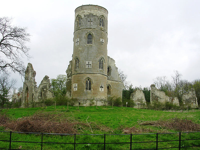
Finally at the top. I could stop and play, but I'm more into heading on, losing two-thirds of that gained height over a short mile or so at up to 35mph. Anyway, this is what the folly looks like.


Wimpole Folly


The Three Cams

Well, I hit the local plain floor and head towards my food stop in Orwell. The roads here do have some traffic, but most are having a pleasant day at Wimpole Hall and are in no mood to rush around in a bad temper. They are much more likely to pass wide, clear, and going a lot slower. Crossing the A604 is not so easy. Again there's a useful side path, but it's not designed for pedestrians and bikes, so I move to the road quite quickly, despite the 60mph cars. I'm sure they could do better for the short 200 yards that it's needed.


View A604 larger

Still, once past that, the centre of the village of Orwell is very pretty. I have a bit to eat to keep energy levels up.


Food stop at Orwell Church

And a summer pass showing a Pannier Market!

So, onto the Three Cams. Well, a bit of license here, but these three rivers define the shape of the valleys up water from Cambridge. They all flow through Cambridge as the river Cam. The Rhee and the Granta meet at Hauxton Junction just above Byron's Pool. Just up the Granta branch it amalgamates two rivers again, this time called the "river Granta or Cam" and the "river Granta". Wikipedia has the orginal name for Cambridge as "Grantebrycge", hence the river name.Thus the 3 rivers above Cambridge have 3 names, but 2 names can mean 2 different rivers. Hmm, give me calculus....

The river Rhee goes through the villages to the west all the way up to Ashwell just in Hertfordshire. This is the first river I'll cross, just after Barrington. I notice that my speed on the road is much quicker than the previous track experiences, but then I cross the Rhee and my speed drops! Even what looks to be flat around here, isn't so much. Do note that people here call the river the Cam. Hmm.

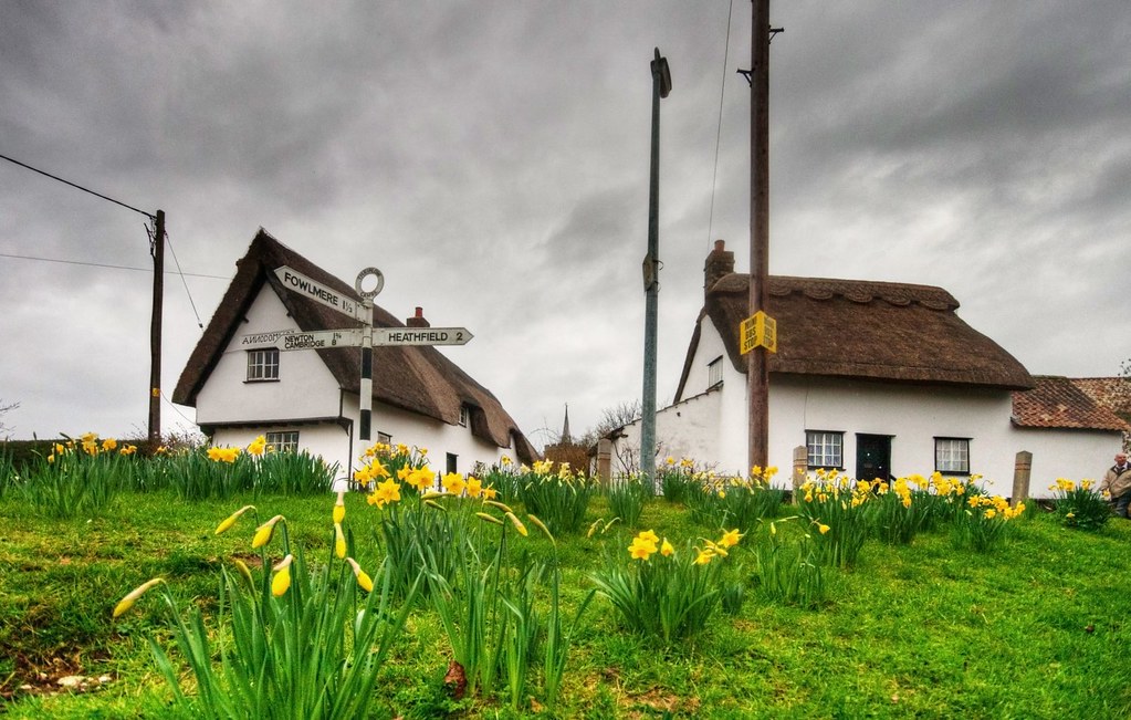
Just after that I have the first level crossing experience. Luckily not a long wait, unlike the Tour de Suisse the day after!  The villages of Shepreth, Fowlmere, and Thriplow are all pretty, the latter especially during it's daffodil festival. The roads between are fast but dull, barring the horrible crossing of the A10.


Daffodil festival by Rouguesgallery17 on Flickr.


In Thriplow, taking a back lane finds the recently upgraded Drift Track. It's now a bridleway, so open to people cycling and is a convenient way to get to Whittlesford.

In Whittlesford, a local footpath has been converted to a new cyclepath to the large village of Sawston. This is mostly to do with school children, as the latter has big schools for the local area. There is some concern about the lack of signage for this path. And you see that I don't take this route. I've always found Church Lane more pleasant, although this isn't the main route and again is confusing with the signage.


Photo from cyclestreets.net looking back towards Whittlesford.

A certain amount of amusement can be had from the "Slow Pedestrians Ahead" signs with the lack of comma after "Slow". But it is a massive improvement on the "Cyclists Dismount" sign, which is it's equivalent. Just to note, the "Cyclists Dismount" sign is not an instruction/order (it's a blue sign) it is a request.There have been a number of campaigns against the misleading wording of it.

At the end of this path is the crossing of the "river Cam or Granta", altogether more pleasant than the crossing of the Rhee. This river is the biggest of the three and goes up beyond Audley End. My Saffron Walden route covers this well. I canoed down from above here the Easter when I was 11. I got wet, and during overnight camping, it froze. Needless to say, not the happiest experience.

Anyway, the second level crossing experience happened just after this. Again, not a long wait. After the crossing, there was a distinct lack of signage. The route actually goes to the right of the road and onto the pavement. But that's not clear, there are no signs.

In Sawston the cyclepath quickly disappears. This wasn't too much of an issue on a Sunday afternoon. I just wonder what schoolchildren experience going along this road at just before 9am on a weekday, at the same time as many, possibly rushing, people driving?

Again in Sawston the signage is a bit lacking. A route continues on the pavement up north from the main crossroads. It's not easy to get onto it if you've missed the previous dropped kerb with the only nearby drop right at the lights. This route north isn't too bad. It is a bit thin, a bit rough at times, and has some unnecessary conflict with bus passengers. It's better than being on the road here, though.

When rejoining the A1301 it does the most ridiculous route. It actually crosses one more road than necessary. Why?!

Extra unnecessary road crossing in less sunny times from cyclestreets.net.

It then does these series of close wiggles designed to slow people cycling down. Of course, the result is lots of off-road cuts where people cycling have just given up and smoothed the corners. I guess the principle is that theyy should slow down to stop before crossing the more dangerous A1301. And, given people driving blast along here at 60mph (and more!), it's possible to understand that point. However, with the clear lines of sight, the loud noise of traffic on the roads, I can't see any person cycling missing the danger of this place.

After this the cyclepath goes into Stapleford. The path is separated from the road, but still narrow and shared with pedestrians. It does have a nice little side route away from the road whilst crossing the "river Granta". However, getting onto this from the other direction is a task, and sharing with pedestrians is not ideal either.

My Photo from cyclestreets.net.

The "river Granta" follows the valley up through Linton to Haverhill. Again, this appears on my Saffron Walden route.

Through Stapleford on route NCN11, up Church Street and along Mingle Lane, passing the village church.

View Larger picture

Then onto the Addenbrookes cycle path and south Cambridge Guided Buway Cyclepath, which I've written about before!

Full Video Clip


This shows the full trip at 8 times speed. Key points are as follows.

00:13 Cross Hills Road
00:28 The Coe Fen
01:27 West Cambridge Cyclepath
02:44 Off-roading from Coton
03:31 Permissive bridleway
06:42 Kingston village
08:44 Wimpole Folly top
09:32 A604 path for people cycling?
09:57 Food stop in Orwell
10:55 Barrington
11:09 Crossing river Cam or Rhee
11:29 Level crossing
13:36 The Drift
15:19 Whittlesford Cyclepath
16:28 Pointless road crossing and slalom
16:43 Crossing "river Granta"
17:19 Addenbrookes Cyclepath
18:02 South Cambridge Guided Buway Cyclepath


Tuesday, 15 May 2012

South Cambridge Guided Busway Cyclepath

Or why even good infrastructure doesn't get used


Yep, that's a bit of a mouthful! From Cambridge Railway station a full 2 miles south to both the Trumpington Park and Ride and, via a branch route, to the west side of Addenbrookes hospital the guided busway has been built along an old railway route. Next to it, a 4+ metre wide cyclepath has been installed. The route is quiet, traffic light free, with plenty of space for overtaking and passing pedestrians.

I can only imagine the general response from cycling types as "wonderful, sounds like you're living the dream in that there Cambridge". However, it seems to be hardly used. Compared to the cycle traffic along the nearby Hills Road there seems to be minimal numbers of cyclists on it.

So, why is this? I think there are several reasons, so let's have a look.


Route into Town

Some issues arise from thinking where people are trying to go. The cycle route has very little entrances and exits. This means cyclists can pretty much only go all the way along it. There is one public egress on Long Road. However, it's a 200 yard long east-west traverse, making it all but useless apart from a few houses towards the west end of that road. Apart from that, there are a few gates into private companies. These are usuable by members of the public going through car parks and so on. However, they do tend to be locked outside of office hours, and have lots of "Cyclist Dismount" signs. Not exactly useful.

Trumpington Routing

Here is the route that goes in from the Trumpington Park and Ride to the Station.

Yep, it looks great. And maybe that would help for drivers coming from out of town needing to catch a train. It sounds not unreasonable. Except that there are a number of train stations amongst the nearby villages, so very few people are likely to come into Cambridge to do this. It's easier to go to the village stations.

Then, just moving the destination a hundred yards or so to Hills Road, and the recommended route changes away from the cyclepath.

That's because, even with it's "smooth" curve, the cyclepath would be just longer. In fact, Hills Road is a good boundary. This extends up to Glisson Road, then uses that to Mill Road, and then to the west of Gwydir Street up to Newmarket Road. So destinations in about half of Petersfield are shorter along the cyclepath. To the west and north, it's shorter along Trumpington Road.

Mills Road bridge and the cycle bridge do make the west side of Romsey Town also good along the cyclepath. Again, this is quite limited.

Now, just moving the start a hundred yards or so into Trumpington, and the recommended route changes away from the cyclepath.

This time, the break is just around Tenison Road. This means that all routes that are not specifically to the station are shorter not using the cyclepath. Ah. Suddenly it seems there might be a reason that the cyclepath is not being used. Unless the cyclist is starting in the Park and Ride, the route into town is shorter elsewhere than using the cyclepath. Even if they start in the Park and Ride, unless going to the east side of Petersfield or the west side of Romsey Town, the route into town is shorter elsewhere than using the cyclepath.

So, the relative small and quiet sections of town are served by the cyclepath, not than the rather more busy town centre (in orange).


Addenbrookes Routing

Ah, but what about that branch, surely that helps drag people in. Well, maybe, except that on a broadly speaking north-south route, the branch goes 500 yards west-east.

This means that a lot more routes are quicker than using the cyclepath. Even coming from Shelford along the great Sustrans cyclepath, which is the closest to the cyclepath, it would be preferable to cycle along a couple of back roads and Hills Road when going into town. The area of Petersfield that is quicker on the cyclepath is much smaller than above, and the Romsey Town area has gone completely.


Google Maps or CycleStreets

I've been using Google Maps walking directions to calculate these areas. This is in beta so maybe not entirely reliable. However, I've also looked at CycleStreets, which is well sourced to calculate this as well. It essentially agrees, just is a little more unmanageable handling rapidly moving start and end points (it's still very good though!).


Here is the quietest, shortest, and fastest routes to Hills Road.


Going to north-west Petersfield does give a the quiet route along the cyclepath, but that's it.


Possible Additions

One suggestion by Cambridge Cycling Campaign is to run a ramp up from the cyclepath onto the side of Hills Road Bridge. This really isn't a bad suggestion. This would almost certainly add a section to the west of the Petersfield area, including some of the city centre, into the "closer by cyclepath" areas. This would take up a very small amount of space, possibly taking 3 or 4 parking spaces away from the company. I'd suggest it'd make a bold and strong positive marketing element for the company that did that. Having your name emblazoned across the local paper saying "we thought it was good for Cambridge" is not bad publicity at all.

This is where the ramp would start and head up, possibly turning to the left, to the darker bridge brickwork, possibly towards the left end of it.


And this is where the ramp would end, towards the end of the darker brickwork. It would join in with the good cycle lane heading into town.


This would need to be a one side ramp, so only accepting cyclists from this side of the road onto or off it. I don't think there'd be much difficulty encouraging this. If coming the other way (so from ahead), it's much much easier to get onto the cyclepath by turning left (at the lights in the distance) and joining the cyclepath going under this bridge. It gets round the Cambridge cyclists notorious nemesis of having to ride up anywhere (for any height, whatsoever, including bridges!). Going under the bridge for that direction would be a much easier and more appealing journey.

However, for cyclists coming along the cyclepath and wanting to head into town along Hills Road it would nicely cut of a big corner, making it appealing for many more (and busier) destinations in town. At the moment, trying to go under the bridge and come back to Hills Road is really poor. It can't be done on the bike properly. Here's a clip why.


This shows that any cyclist ends up at lights that only allow a left turn back over the bridge. The only option would be to dismount, cross the road at the pedestrian crossing, then join in with traffic again. The phasing means that there is very little time for crossing within a full 100 second cycle. Most of the cycle is dedicated to traffic going over the bridge, hence the RAMP!

Here's a clip of what would happen instead (ironically ending in a red light!).


Pleasantness

All I've talked about so far is how short the route is. For many cyclists this is the most important issue, just to get from A to B without spending any more energy than is necessary. However, not all cyclists think that. I don't.  In fact sometimes if the route is simply a few hundred yards further over a couple of miles, but is much more pleasant, I'll take that route. So, I do use it, despite coming up the Shelford Sustrans path.

I get away from cars, something I relish. Also, away from the trappings of cars, like traffic lights, which slow my route down. However, even then it's not made very easy.


Francis Crick Avenue

The lack of joined-up thinking here is a real pain at times. Classically, the total route from Shelford ot the Station, just over 3 miles, is mostly two-way offroad. Apart from about 400 yards along Francis Crick Avenue. It splits across the large road into 2 onroad cyclelanes. No, I'm not kidding.

Ah, you'll be thinking this is a limited space place. No, surrounded by fields. Perhaps it was built a long time ago and it's not been updated since. No again. This was build a couple of years ago. Ah, perhaps they didn't know about the other developments. No, again. The Sustrans cyclepath pre-dates it and the guided busway sections were being built alongside it. So, why did they just not bother? Simple, no joined-up thinking. What is even more silly is that over the railway bridge (looking back from the below photo), the cyclelane IS two-way on one side, all the way to the next lights.

This shows just how ludicrously badly thought through this section is. Notice the vast amount of space to the left. Plenty of space for a 4 metre wide two-way cyclepath joining up the two longer sections. Although the side of the road looks nice and smooth now, it's only a matter of time before this gets strewn with debris from cars, and those drain covers look none too pleasant to catch a bike wheel in. Yes, this was designed in the past few years.


Going this way is poor, trying to go the other way is just plain idiocy.

Cyclists have to cross the road at the other end, luckily there are lights to wait at if working through traffic doesn't appeal. Well I say luckily, it's still a big waste of time compared to what could have been done here. Then, 400 yards later, when trying to cross back across the road to get back on the path, the route is effectively a 2nd/3rd (well, right) off a roundabout, taking a good extra distance round and forcing cyclists into a mechanism designed for cars to mingle, not them. As might be expected, the few cyclists here use the footpath or cross the road early to get in before the roundabout.


Weather

Yes, this is where all non-cyclists say "but surely you have to accept bad weather and conditions if you want to be on a bike?". And whilst I'm happy getting wet (as usually "cold" doesn't come with that) that's not the issue. Most water hitting cyclists, especially in Cambridge, comes from the ground, not the air. It's the standing water that splashes up that makes more of a mess than that which comes from the sky.

And this is where the cyclepath follows the same issue as many around which does not happen on the road. Today, I used the cyclepath about 10 minutes after a short shower. The spray coming up was a good drenching. It was not dissimilar to going through a 1-2mm deep puddle for over a mile. I got to the railway station and turned onto the road. It was completely dry. This wasn't because there had been a constant stream of traffic along it, drying out the road with repeated tyre wiping, I'd not seen a single bus. No, it's just down to the tarmac used and drainage developed. No thought has gone into draining the cyclepath in comparison to the road. Simply put, if that's the choice, many, many cyclists will choose the road. This is something nobody wants, really. So why not think about cyclepath drainage!


Summary

It's pretty simple, build it and they will come. However, you have to make it appeal. This is the basis of the free market that will pull cyclists onto the route constructed. Fail to think through simple things and it will not be used.

Making it easy to get on and off would be a good start. Just adding the Hills Road Bridge ramp would be a big step forward. Maybe connecting up across the open spaces to the paths and residential roads on the east side of Trumpington Road might pull people in and do more to encourage people from the Trumpington Road route.

Above all, joined-up thinking. Don't just put the tarmac down and just expect people to get on it. Think what would make people more likely to use it. And drainage would be one big thing!


Tuesday, 18 January 2011

An Hour in a Cyclepath: Hills Road Station Road to Brooklands Avenue

Some safety concerns with 70 vehicles in 1 hour in cycle path

A technical and emotional note about the reasoning behind these blogs.

Along Hills Road there have been some fantastic developments to help cyclists travel and protect them from general traffic, whilst also aiding traffic flow. The new Hill Road Bridge is a good example of some well thought out design. I was a bit concerned that the previous version, which was so good, couldn't be improved upon. I was wrong.

Enough about the bridge, I'm more concerned with other bits here. The section of this city-centre-to-town-outskirts route between Station Road and Brooklands Avenue is proving a little difficult for road users. Here it is in detail on a sunny day.

Notice the cycle-path sign right at the beginning, but also notice the dashed white line on it's edge. What does that mean? Then, at 15 seconds in, a bus-stop appears, directly after which a cycle path sign appears. I assume this to make sure it's obvious that this is only a cycle path from the end of the bus-stop, so bus drivers know. Again, that dashed white line borders the main road. Then at 36 seconds a second dashed line appears in the middle of the lane, about 1 metre outside the bike lane. Now, what does that mean? At 46 seconds, the dashed line bordering the cycle path disappears leaving the other dashed line which gives the appearance of a two car-lane approach to the coming junction, despite roughly two-thirds of the inner lane being covered by red cycle path tarmac. Finally, the red tarmac disappears at 51 seconds at the pedestrian crossing.

So, where is there a cycle path along this section? Where should cyclists feel protected from traffic?

Let's start with what does that dashed line mean? Article 140 of the The Highway Code makes it fairly clear.

  • Cycle lanes. These are shown by road markings and signs. You MUST NOT drive or park in a cycle lane marked by a solid white line during its times of operation. Do not drive or park in a cycle lane marked by a broken white line unless it is unavoidable. You MUST NOT park in any cycle lane whilst waiting restrictions apply.

Or does it? What does it mean by "unavoidable"? I have to cross a cycle lane when I park, that seems pretty unavoidable. But what about just to avoid non-moving traffic that isn't going the same way as your vehicle? As mentioned, this is on the way towards a junction with two separate routes for traffic. So maybe to avoid stopped traffic in the outer lane (waiting to turn right) is considered "unavoidable"?

I've tried looking up the Road Traffic Act (as referred at the bottom of the Highway Code quote) but can't find anything readable. Mind you, this means there's an interpretation under law here, not just the Highway Code. I think I'd choose the interpretation that short of crossing the cycle path, any entry is avoidable.

But then there's the problem of when does the cycle path end. When the second dashed line appears? When the first dashed line ends? Or when the red tarmac ends? Again, I, like most cyclists, would suggest that the red tarmac is the defining issue. But that second dashed line does confuse most vehicle drivers.

Here's a short video (turn the sound down, Radio 6 was on!), taken over one hour that I've cut to pick up vehicles straying into the cycle path. In all fairness, most vehicles did stick with my interpretation of the cycle path and avoided the red tarmac. However, this video is over 6 minutes long, implying that for 10% of the time, there is a vehicle on the red tarmac. This shows that a significant proportion of vehicles either are confused or don't share my interpretation. And, just to add, I didn't pick up the large numbers of vehicles that just clipped the edge.

I make that a total of 70 vehicles including 37 cars, 22 buses, 5 taxis, and 6 vans (please do check, I may be one or two out!). Two particular items to note: at 2:06 a learner/instructor driver and at 5:07 a cyclist having to make a manoeuvre to avoid a car pulling into the cycle path.

So, what's going on? Although there is clearly a need for better education around cycle lanes, especially if my interpretation of the cycle path is correct, there is a clear need for clarification along this stretch. The road needs to be clearly marked so that drivers and cyclists know what is where. At the moment this just isn't the case.

Clear road markings would help all road users understand their path along the road. Cyclists would know that they need to slow down earlier if their path boundaries are not guarenteed to be free of motor vehicles making manoeuvres. Drivers would know that they cannot just move over because their journey is slightly impeded.

Especially important is the high proportion of buses spotted to buses on the road. Other vehicles have a much lower proportion. (Sorry, no figures, but just look at 22 buses compared to 37 cars, that's 1 bus to every 1.68 cars!) One reason for this maybe that bus lanes and cycle paths are coloured using the same tarmac. Go into town a bit in the other direction, there's a good example outside St Paul's Church. So, I'd guess a proportion of bus drivers think that this is a bus lane, despite the clearly marked cycle path signs early on. Clearly, that's a big educational gap!

Now, I've had further experience of buses in this cycle path, down near the bus-stop. Here is a cyclists-eye view of when vehicles move into the cycle path.

Stationary traffic, what cycle paths where made for! A school student and I are making our way up the inside as allowed. The second bus along is determined to get into the bus-stop and accelerates forwards and into the cycle path whilsts we are on it's inside. HEE-BEE-GEE-BEES!!!! Both of us jam on brakes thinking we are about to be deposited either onto the pavement or under the wheels. With our space cut in half, the bus stops. Not because we have been spotted but because it cannot go any further forward in traffic. We can only tell this once we've both negotiated the limited space left to move along the cycle path. And it's at least 40 metres before the bus stop itself. So, why is it pulling into the cycle path in any case?

If you know any constructive answers to the above questions, please feel free to let me know. And the "constructive" is intended to show I'm not interested in the very-slow-to-get-it drivers who'd prefer to get all cyclists off the road, despite that approach increasing the congestion they'd have to suffer!

Oh, and a reminder of the financial breakdown to the answer of that age-old failed "You don't pay road tax" is here.