One of the barriers to cycle commuting uptake is sometimes something so simple as a lack of a gateway or a missing link. Sometimes it may be just a simple link but needs a bit more effort to establish as it seems like a long, big project but in reality needs someone to show how simple it is.
I grew up in Blewbury in south Oxfordshire (well Berkshire when I was first there). I go back there regularly and ride my bike like I did when I was younger. I had a friend how lived over the hills to the south so I got used to riding up some steep slopes, then trogging through mud for a while. I still go that way, which is great for adventure and slightly hardcore leisure cycling.
However, in these days where we are trying to get more people cycling and less people driving, it's the utility cyclist that needs help. The trip to the shops, picking up the kids from school, going to work, all those things we all do every day. And in this sense, Blewbury is incredibly lacking. It is a complete cycling island in that there are no easy ways out. Here's the
direct link to the HTML map or download it
straight from KML to use in the more flexible (and free)
Google Earth.
View Blewbury Island in a larger map
As I say, the south of the village is a hilly, muddy affair. Great for off-roading but not good for commuting, especially as it's quite a distance to anywhere substantial. The main routes desired are to the north, to the town of Didcot (schools and commuter town for London), and lesser so west, to the big scientific development at Harwell. And the irony here is that there is a great off-road cycle route (
number 544) going through the nearest village, Upton, and to the nearest town, Didcot. But it might as well be an ocean away as it's simply not accessible from Blewbury.
 Valley view by ian freeman
The A417 dominates the local transport infrastructure. It's a horrible A-road that hasn't changed much since tarmac was first laid down many decades ago. It's a busy main transport route around the wider locality. Aside from that the local B4016 which meanders it's way to Didcot is the only other road out of the village. None of these roads are safe for cycling. All of them consist of a narrow two-way road spaces that winds and twists their way between banks and high verge vegetation. A lot of bends are just not quite far enough away for safe overtaking and also not sharp enough to require slower speeds. This gives the dangerous combination of higher speeds along with impatient poorly considered passes.
Other than the difficult and useless tracks and paths to the hilly south and the dangerous roads, there are a collection of two footpaths and one bridleway. Ah, a bridleway I hear you say, excellent, what's the problem. Well, first, it's to the east and really doesn't go to anywhere substantial. Also, Blewbury has a high proponderance of
horses and stables. As great as that is (and I wish them well!), it does mean that some are so trappled as to be unpassable by bike. This bridleway in particular is deep in thick mud in winter and has rock-hard 2-inch deep hoof imprints in summer. It's hard enough on an off-road bike, it's not usuable by anything less.
 View from cycleroute by wedge35
So, onto the two footpaths. There is some hope here. I used to ride one (route A on the map) when I was young. Do note that although there's no right of way, it's
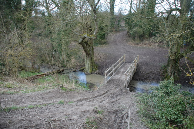
not illegal to ride on footpaths, that's preserved for footways (that is pavements). Having said that, I would not choose to ride along here other than the summer as it is a muddy path at any other time. The other route (B on the map) I wouldn't use most of the year as a section (again marked on the map) is invariably deep mud.
So why not convert either of these paths into cycleroutes? Wouldn't it be great for the people of Blewbury knowing they can safely make their way to the local amenities by bike. Well, several people did think this would be good, so cycleroute A was proposed. As far as I gather, a single landowner objected. Not the main farmer, someone who owned land at the Upton end and didn't want lots of cyclists coming past. And this is despite the fact that by then the path has expanded into a local farm track, so it's hardly a massive change of the pathway itself if at all. So for now, the primary school children living in Upton and going to school in Blewbury will be driven back and forth.
There's one route left, and that's marked as cycleroute B, which doesn't help the Upton primary school children, but will help others. This consists of three sections.
- First, from the village up to the muddy section there is a concrete farm track already in place. This means the initial work is done. Obviously the local council would have to come to some agreement about how the track is maintained, but that's a paperwork job and not a question of having to actually build anything.
- Then, the remaining north-south section is a muddy path alongside grazing fields. This needs work, although it's pretty minimal. The route is already well defined and isn't disruptive.
- Finally the east-west section is already a bridleway used by farm vehicles. There could be a low level approach here, continuing it as a track but making sure the drainage keeps it dry through out the year, whatever the farm vehicles do. If a harder surface is put down that might lead to more maintenance. Again, this shouldn't be too intrusive or difficult.
This route looks longer but actually goes in a better direction than route A for most travellers who would be heading for Didcot. Once in Didcot, there's an off-road cyclepath to the railway station, to the local super store (and Halfords, perhaps they might invest?), and quiet residential roads to most of the main high street.
 Ancient village walls by Tillyfarlar
Within the village, Blewbury is great for riding a bike. It has slow windy roads which avoid the need to be anywhere near the main A-road to get anywhere in the village itself. There's always lots of people walking around which means all traffic is used to doing minimal speeds. But the village is an island. It needs to take the next leap forward and enable people to use their bikes to do a shop, or commute to London or whatever they need to do in the local neighbourhood. It takes me around 15 minutes to cycle to Didcot along the dangerous A-road and cyclepath. It takes around 9 minutes in a car and that's before trying to find a parking space. What's so difficult about this?
So, the village has a good environment for riding within it, and a lot of the residents are ripe for taking up cycling. It's not often I'd go for a ride and not see at least a few riders within the few minutes I'm within the village limits. Aside from that I know there are lots of people who want to ride as they say so. There are peeks of this willingness with signs of kid carriers locally (and in the
Didcot to Upton on NCN544 clip at 1:25).
 Village path by Veronica Knight
What is the missing ingredient? I suspect that hoary old chestnut of "money" is being rolled out again and again. And this is where it does get a little difficult. It would take some money up front to do this. Not a lot. Probably not even into 6 figures which is a miniscule amount compared with the road maintenance program. But the blanket hold on this is just nonsensical. It's just storing up higher costs later on. The current estimate is that for every pound spent in building cycling infrastructure, the future reaps 19 pounds in savings, through reduced healthcare costs (obesity, pollution, etc), reduced road congestion, and reduced accidents.
So, again, why hasn't this already happened?
Video Clip Addendum.
There are a number of video clips embedded on the map, here's a little more about them. I've not embedded them all here as it can lead to increased page load times.
Didcot to Upton on NCN544. This shows how good the route is, the one just out of reach from Blewbury.
Upton to Blewbury Danger. Showing the dangers and potential issues when cycling down the A417. And here's
another one showing just how bad the passing can be, even in the village. 60% were substandard and all passes where at speeds over the 30mph limit.
Blewbury to Didcot. This is the current way to Didcot along the B4016. Not surprisingly people are put off by this.
Woodway. Going up into the hills. The scarp slope of the downs going up around 100m in just less than a mile, taking around 8 minutes.
Descent of Churn Lane (Boham Road). Coming back down the lane from 7:30, but shows how steep the lane is. Full video clip shows off-roading fun in the hills, less relevant to this piece!
Descent of Chlk Pit Bridleway. A snowy descent of one of the tracks. Again showing steepness although also showing fun of off-roading!
Descent from Churn Knob. A snowy descent of one of the tracks. Again showing steepness although also showing fun of off-roading!