So, the delights of early spring in Cambridge when the sun comes out. This ride has lots of cycle paths, quiet streets, open spaces, very pleasant in the early spring sun. Even the speeding close cars on Gilbert Road didn't spoil the mood. Every interaction other than that was with a smile, drivers included!
The start point is from Hills Road near the railway bridge, heading down Brooklands Avnue.
And here's the video of the route. Look out, soundtrack!(Go HD see * below)
0:11 Starting from Hills Road near the Railway Bridge
0:27 Crossing into the Coe Fen
0:41 Over the river
1:06 Cutting through the colleges to Burrells Walk
1:44 Up Madingley Road
2:00 Through the back of hte Astronomy
2:26 Crossing Huntingdon Road
2:51 Gilbert Road, speeding close cars, uggh
3:30 Over Fort St Goerge Bridge onto Midsummer Common
3:50 Keirin anyone?
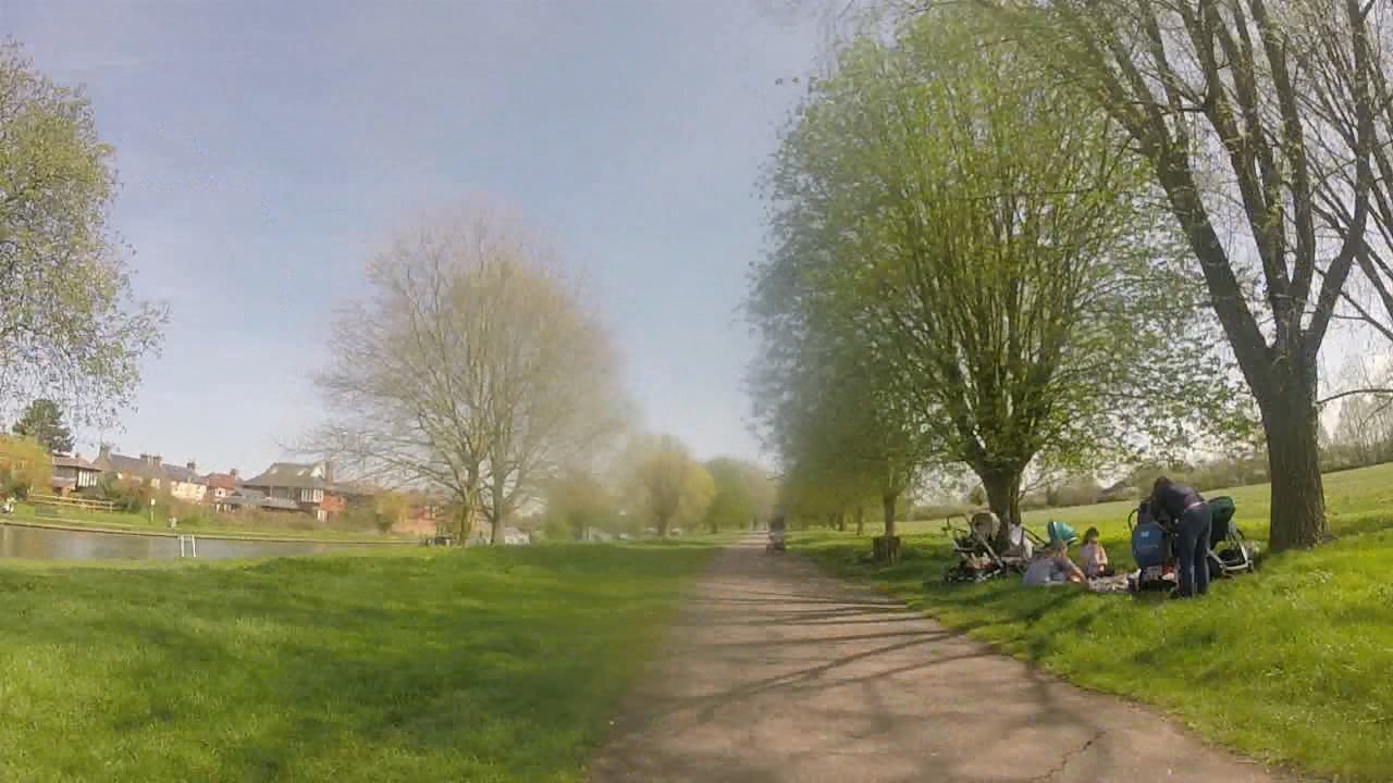
4:05 Stourbridge Common with picnics
5:00 Onto Coldhams Common
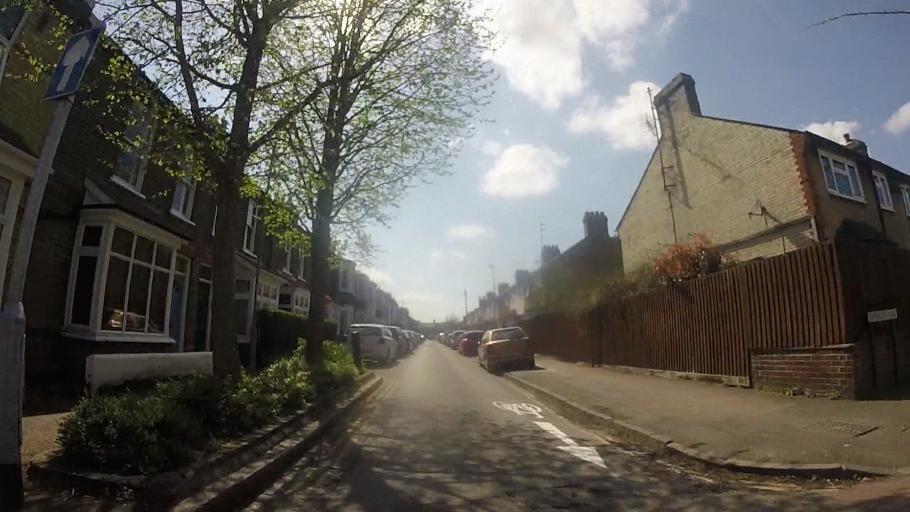
5:36 Sedgwick Street with it's new counter flow cycle arrows
8:00 Railway Cycle Bridge
As planned, the June ride this year was to The Blue Ball in Granchester looking at a couple of sites along the way. And yes, I've spelt it deliberately like that.
And here's the video of the route!
##CamRideHome Does Cambridge North on 30.06.2017 (Go HD see * below)
0:12 Start up Laundress Lane
0:33 Through a poorly placed No Entry sign to get to two-way cyclepath
0:52 Onto Sheeps Green
1:03 Progress temporarily halted by boggy bit
1:16 The newly rejuvenated "The Rush" stream
2:27 Simon goes for a paddle which interests the locals
2:57 Back onto Fen Causeway shared-use path
3:15 Onto Trumpington Road shared-use path, lane opposite not yet finished
3:25 Floating bus stop still being built
3:45 Onto cyclelane from new crossing place
4:00 Up ramp to shared-use path, is it all the way?
4:22 A little known shared-use path to St Faith's School
4:52 Over and up Lathams Lane
5:25 Back onto the Coe Fen
5:52 Brief rain coat stop
6:19 Simon's bike decides to stop
7:25 Turning over the field to The Blue Ball
So we spotted a No Entry sign that's to stop people cycling and driving the wrong way down Malting Lane. However, it also covers the entrance to the two-way shared-use path along Church Rate Walk.
The first main site was on Sheeps Green. In March they renewed The Rush water course by adding in rocks and building the banks with logs and hazel. It looks like it really does rejuvenate the stream, and I spotted an Egret at the bottom pool. I do find it a little incongruous to have rocks in a stream in a flat, fen area, but it does make the stream work.
The second site is the new cyclepath along the east side of Trumpington Road. This change gets rid of the awful doorzone cyclelane and connects to the Brooklands Avenue cyclepath enabling loads of local school kids to avoid the busy main road entirely. Here's Mike Davies talking about the scheme.
We do note that the west side of the road still needs completing as they intend to widen the offroad route. Also, the floating bus stop area isn't yet complete, that should improve it even more. Let's see how the end of Bateman Street works, with loads of school traffic coming out in busy times. It's good to see that they have already removed the railings on the west side shared-use path, there's now a lot more space.
At the end of these sights of sites we'll take a leisurely ride across Granchester Meadows to the delightful little independent Blue Ball pub with it's excellent atmosphere and great beers. Simon's bike decided to give us a little fun as we almost get onto Grantchester Meadows. And we were shamed that none of us were carrying spanners!
So for the June ride this year we are making our way to The Blue Ball in Granchester seeing the sites along the way. And yes, I've spelt it deliberately like that.
The first site at The Rush on Sheeps Green where in March they renewed the water course by adding in rocks and building the banks with hazel. I remember seeing the work taking place and thought it well worth a look to see how this improves the widllife habitat [PDF].
At the end of these sights of sites we'll take a leisurely ride across Granchester Meadows to the delightful little independent Blue Ball pub with it's excellent atmosphere and great beers.
This ride revives my mental state as well as giving a reasonable physical workout. Whilst Cambridge isn't the Netherlands, it's still quite a lot better than most places in the UK. This ride is mostly done on different levels of cycle infrastructure along with some quiet roads.
A few things to do when riding here. If riding along shared-use infra, take good care of people walking. Make sure they know you are there and slow near them. Yes, this really shouldn't happen, there should be separated infra, but that's how it is now. Join onto a road obeying the rules of the road, by giving way to traffic already there. Obey the rules of the road when on the road.
0:11 Setting off form the Fort St Goege bridge
00:28 Slowing under Cutter Ferry Bridge
00:56 Stourbridge Common
01:09 Cows!
01:25 Ditton Meadows
01:48 Care round kids!
02:30 Newmarket Park & Ride
02:56 Airport Way Roundabout
03:48 Teversham Drive in Cherry Hinton
04:00 Church End and Rosemary Lane
04:24 The Tins Path
04:42 Crossing Perne Road
05:08 Crossing Coleridge Road
05:26 Carter Railway Bridge
05:50 The Triangle cut through
06:00 Crossing Hills Road
06:20 Coe Fen
06:54 Crossing Barton/Newnham Road
07:20 Grange Road
08:03 Crossing Madingley Road
08:26 Madingley Rise
09:00 Cross Huntingdon Road
09:24 Gilbert Road
09:56 Crossing Milton Road
10:17 Back on the Bridge!
The route south from Cambridge along National Cycle Network 11 makes a good commuter route for several villages to the south. The combination of separate active (not specifically cycling) infrastructure, quiet roads, some "converted" footpaths (as in with a sign only) make for an interesting mix. It's mostly good but there are some awkward bits where it's not really been thought through.
From the Senate House the route goes directly south along Kings Parade and turns out west through the Coe Fen. In connects up with Trumpington Road and wiggles through a residential area before getting back to the Guided Busway.
This seems like a long way round, and is the longest route here at 2.7 miles to the tunnel under Long Road. However, apart from the city centre and the residential area, both with minimal traffic, it is on separate active infrastructure. Yes, avoiding walkers and cows are part of the hazards, and the path width isn't great to start with. Both times crossing a road, there is a signalled crossing, although noting it's Toucan, so it's clear to cross if there's no traffic even if red. Despite being marginally the longest route this route took marginally the least amount of time.
0:00 Setting off (note slow speed of drivers)
0:21 Turning towards The Mill and Coe Fen
0:50 Cows!
0:56 Crossing Fen Causeway
1:14 Wider path
1:34 Trumpington Road (care with side accesses)
2:15 Crossing Trumpington Road to Residential Area
2:56 Access to Guided Busway
And onto main route south at 0:35
The Alternative Route via the Railway Station (blue on map).
Coming from the Senate House means similar city centre walkers of which to take care then mixing with moderate traffic for 300 yards until turning off onto Regents Terrace on the side of Parker's Piece. Crossing Gonville Place into the residential area south of Parker's Piece then leads to why this route is often called the wiggly route as it does go back and forth in several short streets. There's minimal traffic until getting near the railway station. There is a little link to avoid the station itself, going right directly after leaving Tenison Road and left at the end.
It is marginally shorter than the main NCN11 route at 2.6 miles. There are short sections of moderate traffic and a longer section of very low traffic. However, the two traffic lights, where stopping until green is mandatory means it surprisinly took longer than the main NCN11 route through the Coe Fen.
The Alternative Route via the Railway Station (music warning!) (Go HD see * at bottom)
0:00 Setting off
0:18 Traffic building
0:40 Turning onto Regents Terrace
1:00 Mandatory wait at lights
1:19 Wiggly residential route
1:37 Tenison Road and traffic building again
1:47 Alternative link through to the right
1:57 Bus Station
And onto main route south at 0:00
The NCN11 Alternative using Hills Road (orange on map).
So starting from the Senate House as just above but sticking on Hills Road to straighten out the "wiggly route". At Brookgate, simply turn in left and right to get to the
Hills Road does have lots of traffic. There's a good cyclelane, although it's regularly abused by delivery vehicles (against the Freight Trade Association advice, PDF page 3), and it abandons people riding at junctions, just where it's needed most. As the shortest, straightest route at 2.3 miles it was the marginally the longest timewise. This isn't as suprising when noting the 4 traffic and 6 pedestrian lights on this route.
0:00 Setting off (from 0:40 on clip just above)
0:11 Close car pass (noting they still took the same time as me on Hills Road)
0:21 And back up to the front filtering on the right
0:23 Waiting at traffic lights
0:35 Into cyclelane
0:44 Overtaking slower rider (must look and move out of cyclelane)
1:16 ONLY wiggle through traffic like this if you know the junction timings well
1:19 Turning into Brookgate
And onto main route south at 0:00
Changed Route (purple/brown).
Finally, the map has the "official" NCN11 route (in purple) which goes along Long Road and through the hospital on Robinson Way before heading back out on Francis Crick Avenue. This is the pre-Guided Busway route. Now, this (in brown) is about the same distance and is completely separate active infrastructure, not sharing on hospital roads where speeding is endemic.
I just fancied a short late afternoon lazy ride, which in the late spring sunshine felt glorious.
And here's the video of the route, with pictures along the way!
A Late Sunday Afternoon Lazy Ride (Go HD see * below)
0:12 Start a bit late on Brooklands Avenue
0:56 Lots of people by The Mill
1:10 Town centre is crowded!
1:45 Jesus Green, and lots more people
2:10 Some cows sleeping just before The Fort St George
2:31 Riverside
2:52 Stoubridge Common. more poeple, more cows
3:15 A big horse and a little horse
3:41 Onto an empty Ditton Walk
4:01 Crossing Coldhams Common
4:57 Mill Road, and a driver going the wrong way down Sedgwick Street (see YouTube clip here)
5:12 Carter Railway Bridge
5:46 Into the Triangle and almost back to Brooklands Avenue
Join us on #CamRideHome this Friday for a leisurely social ride starting at 6pm at The Mill, Cambridge. Then a pint after to talk about anything worth a good natter about!
The Ben Hayward Cycles inspired rides on with a quick look to the East. A run along the updated Tins path, looking at crossing Cherry Hinton Hall grounds, and a nice back route through to Hills Road bridge from the Cherry Hinton Road side.
We'll look at these and a few other useful links that help riders get through awkward places.
And here's the video of the route, with a few comments below and Nick Cave and the Bad Seeds giving an extended version of There She Goes my Beautiful World!
The East and the new Tins path (Go HD see * below)
0:00 Leaving The Mill
0:20 Being overtaken by a car about to turn left
0:23 The joys of a quiet Regents Terrace
0:30 Watching being counted by the Gonville Place cycle counter
0:37 The "wiggly path", the alternate route to Hills Road, quiet but not convenient
1:02 Carter Railway Bridge
1:22 Cut through to Mamora Road going on to Brookside
1:32 Cut through to Natal Road and Brookside
1:53 The recently updated bridge onto The Tins path
2:04 Crossing the railway over poorly sighted narrow bridge
2:21 New The Tins path! Don't blink though
2:26 Back to shared-use
2:29 Back to old narrow path
2:37 Clogged Cherry Hinton Road, just too many people driving
2:45 Back towards Daws Lane and Cherry Hinton Hall
2:54 Daws Lane
3:03 Cherry Hinton Hall, very dark, need a good front light
3:11 Exit to the left of the main gate
3:13 Shared-use path on Cherry Hinton Road footway
3:31 Birdwood Road, always pay attention round parked cars here
3:46 Perne Road roundabout
3:31 Radegund Road, rarely use cycle slips here as parked cars usually too close
4:20 Cut through to Clifton Road
4:34 Odd cyclepath on footway, use carefully to get to front of traffic
4:45 Hills Road bridge, with close bus
4:52 Carefully pulling onto Brooklands Avenue cyclepath, difficult in traffic
5:07 Coe Fen, very dark, need a good front light, look out for dogs!
5:30 Pulling well forward at Fen Causeway crossing to allow passing behind
5:49 The Mill, and a pint!
The Tins.
So, The Tins path itself. It's good. And it's good to see that this kind of thign can be done. It needed private developer agreement. There's clearly defined priority and guidance for both walking and riding. Time will tell if the pedestrian section is wide enough that people don't stray into the riding section too much.
It's, shall we say, quite short! And it was quite expensive. That's almost certainly down to the lighting. I'm guessing the development did try to get a quick gain on this as the rest of the route still remains relatively poor. It's probably that the section after Orchard Estate is still narrow and dark. There is space to improve this area but it may require more agreements than this development was prepared to get.
At the end there's a clear indication that more people need to get on their bikes. Cherry Hinton High Street clogged with traffic. It's clogged because as 2 lines of car traffic join (near the church), it needs to be managed to get two lines of big vehicles together into one. Bikes don't need this space. Thus, the jam is caused by too many people using vehicles that are too big for our streets.
The "wiggly path".
The "wiggly path" from Regents Street/Terrace is a reasonably quiet pleasant way to head this way. It's meant to be a replacement for travelling down Mill Road or Hills Road to the station. And it is, reasonably quiet. However, it's not convenient, involves a lot of twisting and turning. Unsurprisingly, Google Maps (with Sustrans support) take the route down Mill Road, it's over 20% shorter to Brookside.
Cherry Hinton Hall.
Next to Daws Lane is the useful green space, Cherry Hinton Hall. This connects through to the south of Cherry Hinton Road. Good front lights are useful to negotiate the darker paths here. The exit is to the left of the main gate, taking you towards a crossing to the south side of Cherry Hinton Road.The footway on this side is also a shared-use space. Note this shared-use path goes through a bus-stop. Another example of shared space between people riding and using public transport. The new style bus-stop, now on Hills Road and proposed in other pace with cycle space separated would seem a much better idea.
Clifton Road Cut Throughs.
Near Clifton Road there are two cut-throughs that help move riders to the front of traffic at Cherry Hinton Road junction onto Hills Road. The last one, along the pavement next to Cherry Hinton Road is very awkward to use and should only be used with great care. There's a good chance that you could end up delivered into trafffic just as it starts to move. It's almost certainly better to use the Clifton Road junction if the lights are green.
#CamRideHome is a leisurely ride around some of the more pleasant cycle infrastructure and cut-throughs in Cambridge, ending in a short pub stop to chat about the joys of the past month. It starts at The Mill in Cambridge every last Friday of the month at 6pm. Rob at Ben Haywards has been instrumental in getting this going and is the route source on their CamRideHome page.
The May ride took advantage of the evening sunshine to explore out to Grantchester, especially as the route is blocked to rat running with the bridge closed. It was a balmy May evening, tee-shirts for some and fleeces for others!
A Relaxed Early Friday Evening Social Ride (Go HD see * below)
0:12 Setting Off from The Mill
0:23 Elliot shows off his signalling skills
0:55 Car pulls out in front, sigh.
1:22 TK Maxx lorry parking up, inches to spare!
2:42 "Daddy faster" as Elliot wants to "win"
3:27 A nice cut-through to Granchester Road
4:25 Bus!!!!
5:20 Green Man in Granchester, a few stop
5:30 Taking care on a narrow path
7:00 Back in Cambridge!
7:30 A naughty trick through ridiculous lights
8:11 Peace in the Valley
8:29 And yet more Peace, a pint!
#CamRideHome is a leisurely ride around some of the more pleasant cycle infrastructure and cut-throughs in Cambridge, ending in a short pub stop to chat about the joys of the past month. It starts at The Mill in Cambridge every last Friday of the month at 6pm. Rob at Ben Haywards has been instrumental in getting this going and is the route source on their CamRideHome page.
The March ride was the first which occurs mainly in daylight. This year we explored some of the new developments to the south of the city in Great Kneighton. New paths are being added to link in with the Southern section of the Guided Busway.
I managed to get video footage until it was quite dark, co-incidentally as my battery failed (how to go HD*).
March 2015 Ride
All together a very pleasant little ride, aimed at the pace of the slowest and with a couple of beers and good chat afterwards. Who's up for April, when we'll be in balmy evening sun all the way?
A short trip round the west and south of Cambridge
It's an excuse to explore some of the off-road tracks to the west of Cambridge, a little bit of rough country, followed by running round some pleasant roads on the flat at a reasonable speed.
The Route to Wimpole Folly
Wimpole Folly sits on the hill above Wimpole Hall in the corner of Cambridgeshire. I'm going to do the 12 miles to it from central Cambridge 75% off-road, and most of the rest on quiet country lanes.
From the station, there's a quick traffic-limited route to the end of Brooklands Avenue. Here, a rider should dismount to cross Hills Road onto the shared path all the way down to the Coe Fen. Crossing Coe Fen is pleasant, but look out for young cattle, along with dogs and pedestrians! After Coe Fen most of Fen Causeway can be done on the side. I choose to come off it to avoid pedestrains but can always switch back on if the lights are against me.
The next bit can be done off-road, but it's very slow, so I opt for the road round to Sidgwick Avenue. A few more quiet residential roads and the West Cambridge Cyclepath beckons. This is a solid route out of town that really gets the miles going. At the end, Coton village offers a mile of quiet roads, then it's back onto the rough "Harcamlow Way". I'm sure the Ordnance Survey map people made that up!
After the first section of this, there is a very useful permissive bridleway. A local landowner has turned over a small amount of land that means anyone traversing this way does not need to go on the road at all (normally for 200 unpleasant yards). This is much appreciated, although probably with horses in mind. Still no nasty fast cars to deal with!
My photo on cyclestreets.net. of the permissive bridleway entrance opposite the previous section of path.
Still going on, the track is rough but wide, a bit damp but not muddy! It doesn't take long to get to Caldecote. There's a lot more evidence of horse use here. Quite a few paddocks and stables to go with the horse-shoe markings on the paths.
South on a quiet road downhill with a small section of the B1046 before heading up to Kingston, another pretty and quiet village.
Exiting Kingston by taking Crane Lane up to the final track up to the top of the hill. More good views as I climb to the highest point of 78metres. Not very much, but I did cross the Coe Fen at about 10metres. There is a very strange arrangement along this track. There seems to be a wide path right next to it. And it's on the map as well. The track is mostly dry apart from a short wooded section. Then a bit of slipping but nothing serious.
The View from the Top
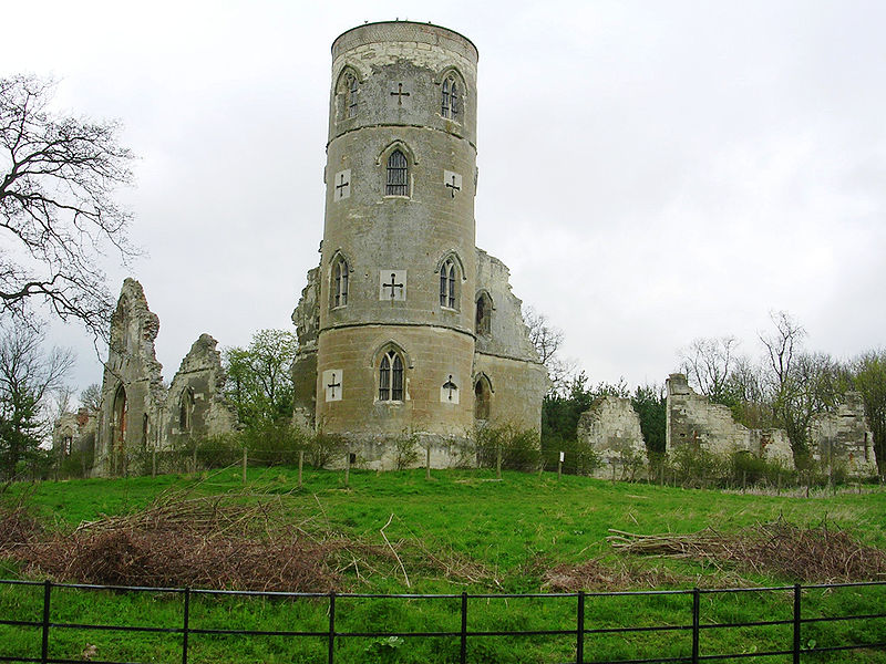
Finally at the top. I could stop and play, but I'm more into heading on, losing two-thirds of that gained height over a short mile or so at up to 35mph. Anyway, this is what the folly looks like.
Wimpole Folly
The Three Cams
Well, I hit the local plain floor and head towards my food stop in Orwell. The roads here do have some traffic, but most are having a pleasant day at Wimpole Hall and are in no mood to rush around in a bad temper. They are much more likely to pass wide, clear, and going a lot slower. Crossing the A604 is not so easy. Again there's a useful side path, but it's not designed for pedestrians and bikes, so I move to the road quite quickly, despite the 60mph cars. I'm sure they could do better for the short 200 yards that it's needed.
Still, once past that, the centre of the village of Orwell is very pretty. I have a bit to eat to keep energy levels up.
Food stop at Orwell Church
And a summer pass showing a Pannier Market!
So, onto the Three Cams. Well, a bit of license here, but these three rivers define the shape of the valleys up water from Cambridge. They all flow through Cambridge as the river Cam. The Rhee and the Granta meet at Hauxton Junction just above Byron's Pool. Just up the Granta branch it amalgamates two rivers again, this time called the "river Granta or Cam" and the "river Granta". Wikipedia has the orginal name for Cambridge as "Grantebrycge", hence the river name.Thus the 3 rivers above Cambridge have 3 names, but 2 names can mean 2 different rivers. Hmm, give me calculus....
The river Rhee goes through the villages to the west all the way up to Ashwell just in Hertfordshire. This is the first river I'll cross, just after Barrington. I notice that my speed on the road is much quicker than the previous track experiences, but then I cross the Rhee and my speed drops! Even what looks to be flat around here, isn't so much. Do note that people here call the river the Cam. Hmm.
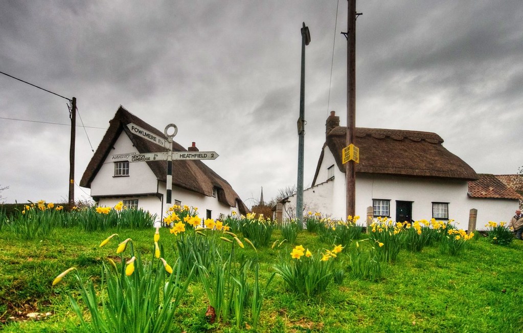
Just after that I have the first level crossing experience. Luckily not a long wait, unlike the Tour de Suisse the day after! The villages of Shepreth, Fowlmere, and Thriplow are all pretty, the latter especially during it's daffodil festival. The roads between are fast but dull, barring the horrible crossing of the A10.
In Thriplow, taking a back lane finds the recently upgraded Drift Track. It's now a bridleway, so open to people cycling and is a convenient way to get to Whittlesford.
In Whittlesford, a local footpath has been converted to a new cyclepath to the large village of Sawston. This is mostly to do with school children, as the latter has big schools for the local area. There is some concern about the lack of signage for this path. And you see that I don't take this route. I've always found Church Lane more pleasant, although this isn't the main route and again is confusing with the signage.
A certain amount of amusement can be had from the "Slow Pedestrians Ahead" signs with the lack of comma after "Slow". But it is a massive improvement on the "Cyclists Dismount" sign, which is it's equivalent. Just to note, the "Cyclists Dismount" sign is not an instruction/order (it's a blue sign) it is a request.There have been a number of campaigns against the misleading wording of it.
At the end of this path is the crossing of the "river Cam or Granta", altogether more pleasant than the crossing of the Rhee. This river is the biggest of the three and goes up beyond Audley End. My Saffron Walden route covers this well. I canoed down from above here the Easter when I was 11. I got wet, and during overnight camping, it froze. Needless to say, not the happiest experience.
Anyway, the second level crossing experience happened just after this. Again, not a long wait. After the crossing, there was a distinct lack of signage. The route actually goes to the right of the road and onto the pavement. But that's not clear, there are no signs.
In Sawston the cyclepath quickly disappears. This wasn't too much of an issue on a Sunday afternoon. I just wonder what schoolchildren experience going along this road at just before 9am on a weekday, at the same time as many, possibly rushing, people driving?
Again in Sawston the signage is a bit lacking. A route continues on the pavement up north from the main crossroads. It's not easy to get onto it if you've missed the previous dropped kerb with the only nearby drop right at the lights. This route north isn't too bad. It is a bit thin, a bit rough at times, and has some unnecessary conflict with bus passengers. It's better than being on the road here, though.
When rejoining the A1301 it does the most ridiculous route. It actually crosses one more road than necessary. Why?! Extra unnecessary road crossing in less sunny times from cyclestreets.net.
It then does these series of close wiggles designed to slow people cycling down. Of course, the result is lots of off-road cuts where people cycling have just given up and smoothed the corners. I guess the principle is that theyy should slow down to stop before crossing the more dangerous A1301. And, given people driving blast along here at 60mph (and more!), it's possible to understand that point. However, with the clear lines of sight, the loud noise of traffic on the roads, I can't see any person cycling missing the danger of this place.
After this the cyclepath goes into Stapleford. The path is separated from the road, but still narrow and shared with pedestrians. It does have a nice little side route away from the road whilst crossing the "river Granta". However, getting onto this from the other direction is a task, and sharing with pedestrians is not ideal either. My Photo from cyclestreets.net.
The "river Granta" follows the valley up through Linton to Haverhill. Again, this appears on my Saffron Walden route.
Through Stapleford on route NCN11, up Church Street and along Mingle Lane, passing the village church.