Wednesday 7 December 2016

Is BikeAbility Useful


So, there was a little come back on the Volvo "educational kit" post I made last week. I did bring into question the nature of the Volvo idea and how it lacked substance compared to what we already do in the UK, BikeAbility. And the comeback was not about how bad the Volvo programme was, but how they don't like BikeAbility.

So, there was a little comeback, just not to me at all. I spotted it going back and forth on Twitter amongst people I know and often share discussions, enjoyment of riding, and fun with. They didn't include me for whatever reason, although that was a little disappointing. And it reminded me that there is a strong anti-training bent to some cycling advocacy people, some with good reason, and some a little less so.

So some of the issues fall down as follows.
  • Training doesn't increase the numbers of people riding.
  • The money could be better spent on building infrastructure.
  • It's just the foundation of vehicular cycling which for decades now hasn't worked for the UK.
Now, a few years back, I'd agree wholeheartedly with these concepts. However, having spent a considerable amount of time since then involved in BikeAbility, I think it's a lot more nuanced than that. There's just a lot more to it, it needs more consideration than just simple statements.


Cycling Levels


We'll start with cycling levels. First, a study has shown that BikeAbility does increase numbers riding to school.
"the survey results show trained children reported they cycle more often, cycle more to school, cycle more on the road, cycle with more confidence on the road, and enjoy cycling more"
This is something I've seen a lot of people denying. But it is there, BikeAbility does increase numbers riding to school (⁰ extra below). The obvious caveat is that this is still nothing like the revolutionary change in numbers required to make ourselves a cycling nation. What's important to note is that The Association of BikeAbility Schemes agrees with that last caveat. That's right, the people who deliver this training do not think it's the be all and end all of cycling. Training is not an alternative to good infrastructure. And that brings us on to the next bit, surely it's better to build infrastructure.


Infrastructure


Infrastructure is the way forward. Full Stop. It is the way in which we get more people riding, more often, and further. This needs to be done at a national level, with national standards, with joined up thinking between different authorities. At the moment we have small schemes, that do help locally, but are a long way from delivering the cycling infrastructure needed to make a difference, nationally.

So, what would it take to do this? Well, the Dutch experience tells us a minimum of £20 per head per year is something like it. That's around £2bn per year across the country (¹ extra below). And we'd need to do that for decades to catch up with the Dutch. What if we dropped BikeAbility for a year or two and took that money and put it into building? Well, at the last round BikeAbility got £50m for 4 years training. So that's £0.0125bn we could add into that £2bn per year, or just under 1% more. Anyone think that's going to make an iota of difference? No, me neither. And in the meantime children everywhere are not involved in any kind of formalised cycling fun (and I'll back that up later).


Vehicular Cycling


So, is it all about forcing children in front of lorries, getting them battle-scarred so they will either adapt (like the 2% of vehicular cyclists) or run away? This premis would suggest that the majority of kids learning will never do it again. But we know that doesn't happen. And actually BikeAbility is so much more than that.

For a start, level 1 never goes near a road. It's all about helping kids get to grips with controlling a bike, usually in a playground setting. It's a laugh! It's fun, it's riding around when they might have had Maths, English, or whatever. And that's a big point. It's fun!

Playing games during this is aimed to cover a series of simple outcomes, but it's still fundamentally bike control. Something you need to ride a bike, wherever you are. You'll be surprised just how many kids may have most of these, but still not quite it all. I think those who've ridden their bikes for a decade or three since, cannot remember those initial learning moments. Some do think there's no need for any training, just get on the bike and pedal. Well, at an early age there can be a lot more to it than that. True, it might not take long, which is why this course is just 2 hours.

So level 2 starts getting the kids on the road. Years 5 & 6 enrol to do this course, often decided by the school, and usually with around 70-80% uptake from the class. Most of them start a little nervous but end up loving it. One or two do keep those nerves through the course, and a tiny amount stop. I'd suggest around 1-2%. This is usually on quieter roads, although sometimes they can be a bit busy. Kids actually respond much better in those circumstances.

In addition to that, part of level 2 is looking at use of cycle infrastructure. This is where we get to point out how bad some of it is, and how to deal with it in all circumstances, both on- and off-road.

So, it's not all about roads. It's aimed at what the kids need for today's cycling. Not next year's, not a decade from now, but right now, in the environment we have. If we decide to wait until the infra is built, there will be no riders left to get on it.

So what if we get loads of new infra? We adapt to training to suit, like it's already being adapted. And this is again, how the Dutch deal with it. Yes, they do cycle training over the North Sea. In fact, it's pretty clear they do something similar to BikeAbility, including being on roads, albeit with a change of focus for the amount of infra they do have. Use a route to school and cope with the differing hazards along the way. This is pretty much how level 3 is delivered here. This will involve less roads but clearly not none and have the same kind of hazard perception learning that BikeAblilty is all about. Hazard perception is another thing linked with BikeAbility successes. So this is something that the Dutch seem keen on as well. Again, this isn't just about motor traffic but it does form a key part.

BikeAbility does a lot more educationally that just bike riding


Summary


One final thing that could be levelled at BikeAbility is that it gives those in charge the excuse to do nothing else. Again, this is the argument of defeat. Dos anyone really think that if we stopped training we'd have loads of time from people in authority deciding they need to now spend time working on cycle infrastructure? No, I don't think so. We do need to do push to do more, we need to do it all. Cycle Training for kids is not the most important thing, but it is part of the solution.


So let's go back to those issues.
  • "Training doesn't increase the numbers of people riding." - Well it does, but we do need to do more.
  • "The money could be better spent on building infrastructure." - Well, not really, it's just not enough to make a difference. We do need lots more to do infrastructure.
  • "It's just the foundation of vehicular cycling which for decades now hasn't worked for the UK." - Again, no longer really the case. Whilst some of it is based around realistic training, there's lots outside of that.
I do still get why people feel uncomfortable as BikeAbility was born out of a vehicular cycling manual. However, it's changed a lot since the start, and actually wasn't as VC as some people might suspect. Put simply, BikeAbility is fun, does get more kids cycling to school, is a good use of money, is realistic in training needs, isn't all about roads, and the kids love it!

We have the firm blueprint from over the North Sea, infrastructure and training, let's get on with it.


-----------------------------------------


⁰ Newly developing courses such as BikeAbility Plus, which has an even more holistic approach, have been shown to really improve cycling numbers.

¹ Whilst we get this figure from the Dutch, it's interesting to note that similar schemes in the UK to those in NL seem to cost around 5 times as much. The suggestion is the Dutch spend a lot more, just don't see it as part of cycling building. It's folded into other budgets but benefits cycling as part of something else.

Saturday 3 December 2016

Volvo Road "Safety" Programme


Fantastic! Some altruristic company that makes trucks is finally acknowledging their part on keeping vulnerable road users safe. I can't wait!


But then I looked through the "educational kit" material. Oh, it's for people riding only, with a few notes about how hard it is for people driving, because obviously they are the only people thinking about this. Hmmm.

Well, let's keep going. I was thinking there would be lots of "see and be seen" actions that are taught in #BikeAbility, about moving out and holding the right part of the road from an early position, about getting eye contact, about signalling, about knowing when you have priority. And how people driving respond to that.

But no, there's none of that.


A Bit More Analysis


There's lots of pretty pictures, lots of photos showing sharks have sharp teeth and cactuses have sharp needles. Yes, I hear you asking, quite what that has to do with cycling? I've no idea too!

The only bit that has any relevance to road cycling is a few diagrams showing where truck drivers can't see people low down. Yes, this is just a sexed up version of Exchanging Places.

So, let's just get this straight. A company that can design a truck so that the driver could see people lower than their cab, doesn't do it. Something in their control and THEY DON'T DO IT. They just tells others that their lorries are designed NOT TO SEE YOU.

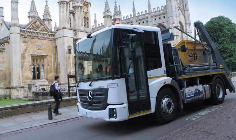
To show you just how poor this response is, look at the way one truck company in Cambridge, the cycling capital of the UK, is working on this. Mick George is phasing in these lorries where the driver can see much clearer.


In Depth


The presentation is very flash, there are lots of very cool images and videos, although embedded in a Powerpoint presentation so there's no way of pulling them up and analysing them bit by bit. Then, to add to the confusion, they are all based on the European standard of driving on the right. This does get very confusing, and probably especially so to any child that this is aimed at. Why do all this flash photo and video stuff, then not get it the right way round for the UK? It's not hard to do!

So, onto the key frames that are important. Here they are in one diagram.


So, A and B are about people walking not riding. Let's knock them off for now, although they are also pretty ridiculous. C is a definite stupid move from someone riding. I'm not sure anyone disagrees with that and also it's pretty obvious. What's the education statement here? Even young kids know this. Don't move out in front of a large vehicle. Duh!

Then there's D and E. Oh gosh, I don't know where to start. The diagram at D is a classic example of just very poor driving from the LORRY DRIVER. How did they overtake, then turn across the rider? When looking at the notes, this is not what the lesson is meant to be about, the diagram is very misleading. This is meant to show a lorry stopped at traffic lights, then a rider coming up the inside (on the wrong side for the UK), then the lights changing and the driver turning to the inside (on the wrong side for the UK). Has the driver indicated they are turning whilst stopped? No idea. Why are there no lines on the diagram showing a traffic light scenario? No idea. What educational value does this have set out like this? Really, really not sure it has any the way it's presented.

And then E. Again, not very clear what on earth this is about. Looking at the notes, this is meant to be a quick lane change due to something going on ahead. So, this is ON THE DRIVER again. They shouldn't be doing emergency moves into vulnerable road users, whatever is ahead.


And, as a final point to the absurd, the presentation has lots of film of people mountain biking. What on earth has that to do with utility riding? And, just to push another irrelevancy, one section starts with the silliness of not wearing a helmet. YES, I'd use a helmet when off-road jumping and risky riding. This has no relevance to road riding. Go on, show me how well that'll go down in The Netherlands. The land of cycling that virtually no-one uses helmets because they are not relevant. Or, importantly, will do ANYTHING FOR YOU IF YOU ARE HIT BY A LORRY.

So, to parody Macbeth, this a a flash, pretty presentation full of sound and fury signifying nothing. And yes, you need to look at the quote just before that.


What Should We Do When Riding?

Well, the first thing would be to not accept these dangerous lorries on our roads. They are designed dangerously. Simple. Another thing would be to press for places where people cyling and lorries do not mix. Again, design the danger out.

And, what's the positive thing to do right now? Simply put, read the Highway Code (221) that says don't ride up the inside of HGVs. Make sure you are seen by putting yourself in a position where you can see drivers. Look for mirrors. That's it. That's more than this presentation is about.

Further training, if you want it, is through #BikeAbility. This is so much more than this presentation. It involves quite a bit and teaches so much more. It's also taught to ~10 year old pupils in the UK, and around 2 million have been through it. Which does bring up another issue with this presentation. They are aiming it at 12 year olds. This is well behind the UK aim for training.

One thing can be said, there's no mention or visual image of hi-viz clothing or paint. I think Volvo got their fingers burnt when they did that little promotion a year or so ago. That's another story.


Final Marks


So, what's the final score for this? How much educational benefit does it have to people riding? Well, I think I'd give it a 1 out of 10. It does cover "don't pull out of a side road in front of a lorry".

Thursday 1 December 2016

Traffic Calming


So NICE have come up with some important things about how poor our road infrastructure is and how it increases pollution.


I'm especially pleased to see they've pointed out the negative issues speed humps cause.
“Traffic calming measures such as speed humps ... may increase emissions by adding to decelerations and accelerations,” it says. “Ensuring motorists drive steadily at the optimum speed can reduce stop-go driving and reduce emissions.
I'm sad to see they don't talk about the better alternatives, just what doesn't work. I'm sure a lot of motorheads will start yelling "Rip them out now, pollution, think of the children (and let me speed without concern for others)". Obviously, completely the opposite of what NICE is suggesting, although it'd be "nice" if they pointed that out.

Again, we've not got far to go before we see what does work, it's just over the North Sea in, yes, The Netherlands.The Telegraph did a piece (all the way back in 2012) on how they work it out with something called "woonerfs". There are 3 principles behind these areas:
  • traffic speeds are forced down to "footpace", typically well below 12mph. 
  • the principles are applied consistently nationwide so they are instantly recognised by road users everywhere. 
  • legal liability is heavily weighted against the motorist in the event of an accident.
It's interesting to note that this has support from the population and professional drivers organisations.

The piece then talks about how this is engineered on the ground.
Clever use of planting, play areas, chicanes, even the position of the houses, means there isn't a straight road in sight.
And it's praise of the result is great!
there's little need for speed signs; our pace automatically falls to a crawl, underlining the designers' dream that children should roam the streets in safety
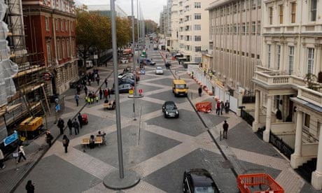
Note that this starts to sound like UK schemes like Exhibition Road which many speed campaigners really don't like. But compare the "Clever use" quote above and look at the picture of this development and you can easily see how the UK scheme totally fails. It's a massive straight space, encouraging speeding and, as a result, pushing other transport modes out of the way.


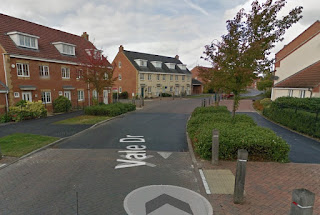
So, why can't we do this in the UK? Actually we already do. Look at new developments in St Neot's and Peterborough.

In Hargate, a new development south of Peterborough, you'll find it hard to find a place with a straight road. Additionally, there are no quick routes through, no road to start on that'll take you all the way through. You have to know your way and make a variety of turns.


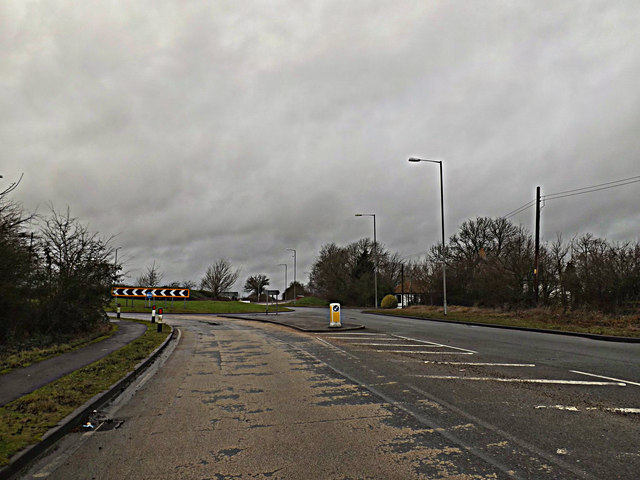
Entering (picture shows leaving) St Neots from the east and the road wiggles around, for no obvious reason. There's space for it to go straight, but it doesn't, it has an open space with trees instead. This naturally slows everyone driving down without thinking about it.


These two areas are showing the main signs of the engineering of woonerfs, although still have a few things to work on. And, of course, it's missing the principle priority issue. The result is ground breaking, as The Telegraph points out.
woonerfs are not only possible but desirable, because they transform neighbourhoods into garden cities
underlining the designers' dream that children should roam the streets in safety
Not only do The Netherlands do this with new developments, but they retrofit older neighbourhoods. The've figured out it's not that difficult to do, unlike our country that seems to accept the blank myth that "we don't have space". We do, we just choose not to be clever about it. The Dutch have been clever.
Woonerfs have been retro-fitted over several square miles of side roads
And to complete the quote from above.
Amsterdam proves that retro-fitted woonerfs are not only possible but desirable, because they transform neighbourhoods into garden cities
So, while we moan about pollution, invest vast sums of money in speeding up our journeys on major trunk roads by a few minutes for a few years only (before it returns to the same old congestion), there's great examples of what we can do to transform our neighbourhoods and remove urban pollution at the same time.

Wednesday 23 November 2016

Lincolnshire Police Give Really Poor Cycling Advice


So this appeared recently as a clipped section from Lincolnshire Police safety advice to children.


I thought the tweet comment was a reasonable summary of their poorly thought out leaflet. I thought it also deserved a lot more analysis and a good run through on how it directly and indirectly contradicts the GOVERNMENT advice on cycling practices, importantly the Highway Code and BikeAbility training.

Lincolnshire Police Leaflet.

The leaflet is here, although I've just focussed on the "on road" statements. It's rather telling that they choose to advertise to children by showing someone falling off. This is well known to play on children's fears and put them off riding. Not exactly a good way to encourage children.

So, the 4 statements they have asserted.
  • A. Never ride on the pavement. Keep to the cycling lanes or ride in the same direction as the cars. This is the law.
  • B. Before you turn a corner, check the way is clear (look behind you) and signal to tell people where you are going.
  • C. Keep a wide distance near parked cars they may siddeenly open a door.
  • D. Keep to single file on the roads, this is much safer.

Statement A.
This is just a really poorly written statement and easily misinterpreted. The "This is the law" bit makes it look like all parts of this are legal requirements. They are not.

1 "Never ride on the pavement". Except when it's a designated cycle path. As written in Highway Code rule 62: Cycle Tracks. These are normally located away from the road, but may occasionally be found alongside footpaths or pavements".

2. "Keep to cycling lanes". No, not a legal requirement at all or even good advice. BikeAbility says ride an arms length from the kerb. For multiple reasons this is the optimal position and is often at odds with poorly designed cyclelanes. This is subtly admitted in Highway Code rule 63: "Use of cycle lanes is not compulsory and will depend on your experience and skills".

3. "Ride in the same direction as cars" is the only bit that gets close to a legal requirement. Although I know many places that have one-way streets for cars that allow people to cycle the other way.

Statement B.
Again confusing. "check the way is clear (look behind you)" just doesn't make sense. It's because it's missing the reasoning and talking about what you are acutally doing.

It is good advice to look behind you and signalling is a good idea. However, the reasons why are completely overlooked and may result in riders doing completely the wrong thing. The idea about looking behind is to enable a rider to move out to a controlling position to stop poor overtaking close to a junction. Also, if there's no-one to signal to, don't do it, keep your hands on the handlebars.

Statement C.
The only statement that has my support. Always "a open door and a bit more" when passing a parked car. This is one of the biggest collision risks with people riding. I will note that advise to look behind when pulling out, vital if passing a parked car, is completely missing.

Statement D.
This is just plain wrong. Doubled-up riding is recommended when dealing with hazards. Making a group of riders look more like a car or bus means a great reduction in risky or rushed overtaking and from oncoming traffic (see here for more details why). Reguarly, BikeAbility instructors will move groups of children around on the road, and they'll employ doubled-up riding quite regularly and when appropriate.

In Highway Code Rule 66: "never ride more than two abreast, and ride in single file on narrow or busy roads and when riding round bends". So, that's not more than doubled up, and don't do it when it might be difficult to do. And to complement this, BikeAbility will teach riders to ride in the centre of a lane when narrow or round a bend to stop poor overtaking then.

In Summary.
It's really important that organisations of authority in the areas covering good cycling practices act and promote consistently. Whilst Lincolnshire Police probably were trying to do this, their half-handed attempt is, at best, poorly thought through. At worst it's just downright dangerous.

Here are all the GOVERNMENT sources of this advice for people cycling, which does seem at odds with what Lincolnshire police believe.

Saturday 5 November 2016

Cycle Parking in CB1

Developers at CB1 are coming down hard on people locking bikes the the tree guards around. They try to claim it's all rail commuters that do this.


I decided to have a look on Saturday, so no weekly commuters included. I find that there's still loads of bikes, a lot not close to the station. Clearly this isn't commuters but locals, a good proportion of which are a long way from the station cycle park.

It's fairly obvious that there's inadequate local cycle parking stands. So this lies soley at the feet of the developers. And there's a clear way to improve the situation, put in more.

Go HD see * at bottom

At the start
0:40 Mill Park
2:00 Station Place


* How to go HD.


Thursday 29 September 2016

King William the Fourth and Braziers Lane


I have to joy of volunteering at Brazier's Park in Oxfordshire every so often. I usually take the Friday off to enable me to set up for our group, just in case the weather or other circumstances make it a hard job. However, the majority of the time, I get a few hours around lunchtime for myself. So, the bike comes out and I ride into the hills.


This is located in the edge of the Thames valley, and is sited just below the Chiltern dipslopes near Goring. Thus it has a bit of climbing, and I choose the pleasure of old tracks for the up and down sections.

A short way into the journey up the first track, the King William the Fourth offers the perfect opportunity to stop and lunch. With awesome Brakspears straight out of the barrel and a good menu it's great. And then the view from outside makes it perfect. The hills and valleys toward the Goring Gap a spread out in front of you giving 10 miles of wooded and farmed landscape. And then, it just gets silly as Red Kites circle in front of you.

And here's the clip (music warning!) with a variety of start points which open YouTube in a separate window.
Go HD see * at bottom

At the start
0:12 Turning Out of Braziers
0:33 Ipsden
1:09 King William the Fourth
3:18 Event Staff
4:03 Turning Out of Braziers
4:30 Great view from top of Braziers Lane


There was an odd thing going on at the farm (in *Homer*, I kid you not!), which meant I met with event staff at the top of the track.

Also note that I met horses on my way round. I start flicking my brakes gently a good 100 yards away. The horses pick up on it first and start turning their heads. I doing it gently and slowing, as braking does, from a long distance out to make sure the animals are aware and the riders do pick it up from a fair distance as well. This gives everyone plenty of time to react, move and take care of all involved.

Great fun for a mid day break from work!


* How to go HD.


Tuesday 20 September 2016

A10 M11 Junction Paths


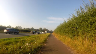
So as part of my cycle to work day (well, week, as that's where I was), I've looked at the full journey there and some relative speeds on the way back. Some people noted that I used the rather poor cycle infra that crosses the M11 at the A10 junction and pointed out that there's a much nicer way. And they are right!

So, here's a map of the area, showing the alternative.


On this map, the orange line is the narrow path next to the A10 road, which you can see either heading south from here (until 2:41, music!), or heading north from here (only to the roundabout, music!). The blue line is the new path round, set up across farm land as a proper cyclepath (not just a permissive path according to cyclestreets) and gets away from traffic going over a farm bridge just along from the main road bridges.

And here's the clip (music warning!) with a variety of start points which open YouTube in a separate window.
Go HD see * at bottom

At the start
0:08 Turning In
0:13 River Corner
1:04 Bridge Ramp (and stop spot)
1:24 Onto Separated Cyclepath (and Trumpington Meadows Park entrance on left)
1:38 Building Site Centre
2:02 Turning Out Across Road


So, which way's best? Well that depends on you!

So, I've favoured going along the narrow path next to the road. Essentially, it's just that bit shorter to make it worthwhile. It's 20% less distance, although it's not quite as much timewise as there's no need to wait whilst crossing M11 sliproads. Again, this is a short distance and it's not much time, but it's still more towards my feeling whilst I'm lugging a reasonable weight around along a 7/8 mile commute.

Yes, I'm crossing sliproads, which isn't too bad but does involve awkward observation and interaction with quick traffic. Also, I'm next to a noisy busy road all the way. And the grass significantly narrows the path (although interaction with other users seems to go fine). Finally, the layby is quikc awkward and I've experienced drivers putting their vehicles into the very narrow path. So there's a number of negatives.

So the quiet path round is, precisely that: quiet and around. It is quiet lovely down by the river, albeit quite a short section. Then it's very much up through rural scenery. Not beautiful, but quiet and pleasant. As you approach the M11 the route joins a farm track and has a stopping spot (an extension of Trumpington Meadows park?).

The farm track over the bridge is steep, and I'm always aware that farm traffic may be around. Coming off the bridge the route goes onto a separate track, something that may well indicate a level of farm and building site traffic nearby. There is the entrance to Trumpington Meadows park on the left, although it's not particularly inviting at this end.

So, to me, the quiet path is further, involves going more up and down, has a steep bridge, and could have some other traffic around on the same infra. It is generally quieter and potentially more pleasant, it's just not that much better to convert me.

I know people put some effort into getting this path and I get why some will like it, it's just not for me right now.

Now, there is something more to consider: where are people cycling to from here? Locally we have the hospital, the railway station (and rail corridor area), and the city centre are the three areas that spring to mind.

Looking at the map, the green routes show how to continue on separated infra to both the hospital and rail corridor area. There's a few poor links here. Having to go round the roundabout at the park and ride will put some off, although I find that traffic is slow here and it feels like crossing a road more than using one. Addenbrookes Road always seems like putting the cycle infra in last, the long way round, and not giving it any priority. However, it does get all the way, as long as you're happy to do a full loop round after the railway bridge.

Onto the city centre? Well, following the railway corridor route does get you going roughly in the right direction, but it's quite a long way round. The best current route (in red) sadly involves a too much sharing with busy traffic. There is a good separated route just north of Trumpington centre, just no way through to get to it (block in red).

However, there may be a longer term strategy in play here. The entrance to Trumpington Meadows park is the clue. This has cycle routes that continue on to the Grantchester Road. The meadows do continue on up to the city centre, with lots of space given over to open (permissive!) access land. There is the potential to use more farm tracks up the east side of the river (currently not in use) and connect into current cycle infra in the Latham Road area. However, there's some pretty obvious big places that might not like that. Hmm, what to do?


* How to go HD.


Wednesday 14 September 2016

Cycle to Work Day


Okay, sorry to those looking for a essay on the issues of this day, I'm just going to enjoy it. I do get that there does need to be a lot more than a day a year where this is done!

Going Out

So my way out provided some excellent views, especially in quite glorious light. The autumn yellows, oranges, and golds are starting to kick in and my route takes me along some beautiful scenery. Bizarrely, for some of it, I'm right next to a road. I'm not sure if I'd appreciate the views as much if I was driving.

The first section is in lower light, but has the fantabulous sight of seeing many people commuting into Cambridge as we go out along the Guided Busway. I'm a little suprised, there were more people riding and walking yesterday, I just must have hit a slightly different spot.

Then the slightly dull section from Trumpington Park and Ride to Harston, via the M11 roundabout. I'm aware there's a separate path, it's just a lot further round so simply doesn't appeal on a commute.

After that, Harston has a slightly small shared-use path. Lots of avoiding being near blind driveways, but still a good route away from most of the traffic.

Finally, the route on to Foxton (railway crossing). The light here is just great.

And here's the clip (music warning!) with a variety of start points which open YouTube in a separate window.
Go HD see * at bottom

At the start
0:17 Guided Busway
1:41 Trumpington Park and Ride
3:13 Harston
4:03 Route to Foxton


Some Stills


Traffic on Return

On the way back at lunchtime, there's the fun of the roadworks. Yes, I mean fun! I measure my progress against a well known beer companies van (other beers are available).

And, yes, I know the roadworks favoured me greatly. However, Harston regularly suffers from slow traffic going into Cambridge in the morning commute. And from the end of this video clip onwards traffic peak speeds drop a lot. It's now quicker by bike.

And some of the route back (music warning!).
Go HD see * at bottom

At the start
0:58 Harston
1:24 Queueing Traffic
1:45 Back to van
2:02 Roadworks
2:56 Back to van


* How to go HD.


Wednesday 7 September 2016

A Short Wenhaston Circuit


I've written about the back route from Wenhaston to the nearby town of Halesworth, with it's new (ish) cycleroute cutting out the unpleasant big roads. This is a short circuit taking in a lot of the above route, but allowing for a bit more back lanes on a pleasant sunny day.

Here's the map, with the circular route in blue with my clip below going clockwise from the start in Wenhaston.


And here's the clip (music warning!) with a variety of start points which open YouTube in a separate window.
Go HD see * at bottom

At the start
0:20 Rough road
0:25 Back of Blackheath
1:12 Bramfield
1:26 Railway bridge
2:26 Holly Tree Farm turn
2:53 Edge of Walpole
3:37 Mells Lane
3:41 Route to Halesworth on left
4:0 Letting car through
4:18 A lot of slippy sand
4:32 Heath Road
4:47 Back Road


Bramfield Road, which loops west round the back of Wenhaston and Blackheath from the centre, gets pretty rough near the farm entrance. A look across at the amount of very large vehicles parked up at the farm gives some indication why this is.

At the next junction, we join Regional Cycle Network route 42 which has come from Dunwich (see other videos and blogs) and Snape before that. Then the Low Road through to the back end of Bramfield is full of wildlife and sometimes pretty farm buildings. This continues on the back loop around Bramfield to the Warpole Road.

The Walpole Road is probably the most likely place to experience poor driving as it's a bit wider than the other lanes. However, it's few and far between. Remember, always ride wide of the hedgerow, as per DfT BikeAbility instructions, you are better seen. The two short slopes go up to Holly Tree Farm where the turn north towards Halesworth appears. Now on National Cycle Network route 1.

This is a lovely route with some nice views, and drops down at the end. Take care as the road is littered with sand and gravel that makes it hard to stop by the main road at the end. There's a quick nip and back on the main road up to the corner before getting back onto a small lane.

Again, more pretty little nooks and corners until the main A road into Halesworth. A short distance to the other side is the turn onto the quiet cycleroute to Halesworth, a welcome relief from the A road. This is where we leave National Cycle Network route 1.

Then, the remains of the journey along Mells Lane into the back of Wenhaston. Note I see a lot more cars here, but none are scary or do silly things. At one point I get a car behind me and decide to find a place to pull over and let them through. I've no desire to have them wobbling around behind me, I'd rather the peace and quiet! Note that this is as I'm heading up hill, if I was in a going downhill at speed I'd keep going. Mainly as I'm going as fast as any driver at that point.


* How to go HD.


Tuesday 6 September 2016

Cambridge to Cambourne Cycle Route


Contents
Intro

Recently I've done a couple of sessions work in Cambourne. Sadly, it's been a car journey as it's just felt a little too far for riding for me. However, I did want to look at the green lane route between the two town centres so decided to do a little exploring.

Map

I've been this way before but never quite made it to Cambourne itself. This time I was determined and had a good look at Google maps prior to trip. Luckily I also looked at Cyclestreets as I'm aware that Cambourne is changing rapidly. Cyclestreets was a lot more up to date, thanks to lots of local volunteers keeping OpenStreetMap updated. Ordnance Survey are good on bridleways in the country, but useless in developing areas, they are just too slow.


The green lane route is not quite the shortest, that's following the A1303 and St Neots Road just to the north. It's 8.8 miles long, which is around 15% less than the green lane. However, the off-road cycle path gives up less than halfway to the destination, depositing riders on a horrible national speed limit wide road. Although the majority of traffic uses the dual carriageway, the remaining drivers often exceed the speed limit and the normal cycle road position are covered in debris and rubbish thrown there by many a passing vehicle. It's just a horrible place to ride.


Let's avoid the unpleasant St.Neots Road by Adrian Cable

Instead, the green lane to the south offers peace and quiet with glorious views across the local valleys and plenty of wildlife. Also, you're far enough out of the city for pleasantries between passing lane users. Give me that over the hurly-burly of the main road any day.

Cambridge to Cambourne
Go HD see * at bottom

00:11 Leaving the Senate House
00:32 Garret Hostel Bridge
01:05 West Cambridge Cyclepath
01:22 Several Egresses to West Cambridge Campus
01:48 M11 Motorway Bridge
02:13 Coton Village Green
02:58 Whitwell Way Path, rough and opening up to stunning views
03:56 Permissive Track near Long Road
04:05 Bumpy climb up towards Hardwick
04:47 Shady wiggle round
05:37 Bottom end of Hardwick, onto more stunning views
06:30 Another southerly shady twist
07:03 Bottom end of Caldecote
07:43 Several gravel water traps across route
08:08 Direct route is half mile to the right here
08:33 Short section of road back north
09:00 Monkfield Drive, access to a pre-Cambourne house
09:29 Gravel paths wiggling through tall grass
09:53 First road in Cambourne, short section
10:05 Path ends next to road without slip onto it
10:12 Centre of Cambourne, it's a bit better than just Morrisons though!


So, overall clearly this is quite a rough route. Once off tarmac or any kind of solid track the path becomes a bumpy dried mud and roots surface. With constant tractor use (it is farmland!) and some horse use, a lot of the mud can be churned up then solidified. Also, with drying/cracking and grassy lumps, lots of factors making it bumpy.

Anyway, starting at Senate House and going over Garret Hostel bridge needs to be done slowly at times. I'm rarely going much faster than people walking here, just speeding up a little in between groups. I'm going at a speed such that I can always stop before I hit someone. Obviously this can be frustratingly slow at times, but needs must.


Cambridge University Library by Bob Kirkwood

After passing the university library on Burrells Walk, the joy of open empty Adams Road followed by the big joy of the West Cambridge cyclepath. The surface here is lovely and smooth and great for getting up to speed. Additionally, people walk on the kerbed pavement, because that's the natural place to do so.

Along the path and on towards the motorway, there are several places where people can in and out of the West Cambridge Campus. I'd think that the path may need to be expanded all the way along here if there's going to be an increase in people using it to get here with this development.

And then the motorway bridge. It's in dire need of repair. Luckily there are warning signs. It looks like the constant pounding of traffic along the motorway has caused the earth ramps either side to start collapsing.

Still on a nice tarmac path, albeit becoming a little worn, and Coton Village Green springs into view. Ah, a fete is in progress. An excellent way to get here by bike then rather than the frustrating wiggle around by car!

On through Coton and out of the other side onto the Whitwell Way path. No more tarmac, as we're on a farm track, and it's pretty rough going. However, it's also where the views are just splendid.


Coton Fields from Whitwell Way by Urthona

This is where a decent surface could start to make a difference. However, I can see difficulties arising on how that would work. There needs to be space for tractors and horses, and they don't like the nice smooth tarmac a good cyclepath requires. However, apart from a few parts, I'm pretty sure that this is all possible. There is no one single solution, each section needs to be taken on it's needs and considered. Once out into the open fields, where the views really open up, there is loads of space to do something specifially for riding.


Permissive Path by timbo

Crossing Long Road north of Comberton there's a permissive path which is claimed isn't usuable for cycling. It looks like it's being used by people cycling (albeit a bit awkward at the road link) and doesn't have "No Cycling" signs just a "Horse and Riders only" sign. Well, I'm a rider! I've been told that this path was added after a horse was killed by someone driving along the road here. Luckily the rider was only shaken, but it does show how dangerous this dead straight road is. A very sad event.

Turning away from the road and the path goes up the biggest climb on the route. Along with it's increased roughness, this is the tough bit of the journey. Again, there's space to do things here. At the top, there's great relief of a shady smoother section during a wiggle round the further easterly tracks.


Shady Section to Hardwick by Me

Finally the path end appears. This is the end of the longest section of off road and marks over halfway distance wise and around halfway timewise. Just clipping the southerly end of Hardwick, the wiggle to the south (again!) is very little distance by road before the next section of farm track. Again, stunning views abound as the vista for miles south is spread out to the left.

In Caldecote, I decide to go along this odd section of cyclepath. It's right up to the roundabout then turn back on myself. Essentially it's some high quality design cycle infra next to the road through a new development. Sadly it just stops at either end and clearly isn't used very much given the state of the overgrowth.


Bourn Path by John Sutton

And onto the final section of rough off-road heading towards Crow End, the top end of Bourn. It was great to hear children playing in a tree house here. There seemed to be quite a number having quite a laugh. And all ages and genders there, clearly enjoying being outdoors.

This path narrows in sections and in the dips there's the remainder of several gravel water traps. Clearly those who put these in simply didn't think people would cycle here. The first time I crossed them they offered a good chance of losing a front wheel into them. Luckily they have started grassing over and have become reasonable to cross.

Just before the concrete track appears, the route starts heading south west. This is just where the route really could go north west as the entrance to Cambourne at Monkfield Drive is just half a mile away in that direction. Instead, it's 1.5 miles round along this track and back up the Braodway from Crow End.


Broadway, Crow End by Me

The road from Crow End in Bourn is around 0.75 miles and is clearly the least pleasant section. I was passed by six drivers in total with one coming far too close without any reason to be further away, suggesting they had no idea what they were doing wrong. That's not a very good ratio.

At Monkfield Drive, a good sized track heads directly towards Cambourne. This is a track for a pre-Cambourne house that currently resides on the south east side of the town. Just before the house, a gravel path splits off to the right. It wiggles round a few trees and a lake.


Cambourne by Wildlife Trusts

There are several paths here with lots of "FOOTpath" and "No cycling exit" signs but none saying which way to go. Essentially riders here must know where to go or they get lost. This may be that I was navigating through long grass with little view of alternative paths, but it seemed like a minefield of "no cycling", where the map had said it'd be fine.

Finally the first road in Cambourne comes into view! Again, it's less clear as to where to go, but I'm going to use the road as it's quiet and short distances. I notice that the cycleroute does go off-road through the residential area, but on three road crossings and through driveways. So good for under-8s and avoided by everyone else. Not good cycle infra.

Then I picked up another off-road cycletrack. Again, this is good as it get's me where I want to go in a reasonable direction. However, on the way back it was just too small trying to share with someone walking.


End of Cycleroute by Me (actually it continues to the right)

Finally, that track ends and I can see the centre of the town where this path is taking me, but there's no drop kerb to get me back on the road. Then I spot it. Rather than going towards the town centre I should have turned away and got onto the road in the other direction. How bizarre. I looked at the map later and it showed there was an alternative route avoiding the road by going the other way, but no signpost. Again, you need to know the place to navigate it.

Cambourne

Cambourne is a very good development in many ways. Lots of open spaces and wildlife preserve. Lots of curvy roads automatically slows people driving down, without it being noticed. No straight roads is a great way to make sure people find it pleasant to move around town actively. And that it's got lots of cycle infra away from the roads is great.

However, two points really let the cycle network down. Signage is vital in this maze. It really didn't exist, which means stopping every minute or so to make sure the direction is correct.

Then the geometry and consistency of the shared-use paths make it difficult to use. Narrow paths cannot be shared with people walking, and they are too narrow regularly. Also, having the route wiggle around the road network is a massive weak spot. If it's made so difficult to use, people will make up their own desire lines. This is likely to either include using the road, which then reduces it's appeal, and/or cutting across places where cycling is not wanted.
  • "Build it [properly] and they will come."
There's a more in depth discussion, albeit slightly old, about the town and cycling here.


Cambourne to Cambridge
Go HD see * at bottom

0:11 Leaving Cambourne centre
0:19 Narrow!
0:40 Nice but a bit slippy on the gravel
1:22 Passing far too close
1:34 And onto the green lane
2:50 Back into Caldecote, kids still laughing in tree!
3:14 Good interaction with walkers, make yourself known!
4:00 Great views here
4:21 Wiggle in Hardwick
5:10 Fantastic views to Cambridge
5:30 Permissive Path
6:00 Whitwell Way, more great views over Cambridge
6:55 Coton centre
7:13 M11 Motorway bridge
7:51 Superb segregated smooth path
8:35 And slowing down a lot, so many people
9:07 Cambridge centre


The return journey is filled with similar experiences. A few notable exceptions are:
  • coming downhill on the gravel paths in Cambourne is a bit slippy
  • a really poor pass on Broadway in Crow End, Bourn
  • a nice tailwind and steady downhill makes it feel so much quicker
  • views towards Cambridge open up from quite a distance, spectacular!
  • a small slow down on Burrells Walk, followed by a much greater one on Garret Hostel Lane

Some Statistics

This route is 10.2 miles or 16.3km long. It took me almost exactly an hour to do the route out to Cambourne. Now that does entail 76m of climbing, starting at 14m above sea level and ends at 71m (so there is some downhill too). Note that it took me 53 minutes to come back into Cambridge. That did include having a goodish breeze behind me, but not too strong.

Summary

Interestingly, compare my cycling speeds to the 45 minutes I allow when I drive to Cambourne. Suddenly, my cycling speeds are not far off the driving speeds. I can imagine people simply not believing this. However, when driving I do need to factor in that I might get held being part of a traffic jam and I do need to find somewhere to park. Both these things do not come into cycle journey planning. And take note that if these tracks are well surfaced, they'd be a fair amount quicker.


* How to go HD.


Thursday 25 August 2016

New Railway Bridge and Station Access


So the access to the "Carter" Railway Bridge and links through into the station have just been improved. Just how much better is it?

Contents


How It Was

This is the way it used to work (click images for video).

Over Railway Bridge from Devonshire Road
Showing limited access, conflict between directions travelled


From Railway Bridge to Devonshire Road
Showing limited access, conflict between directions travelled, and limited visibility


Station Carpark access
Showing narrow twisting space, conflicting between walking and riding


The Plans

Well the plans [PDF] have been around for a few years now. As well as some comments on Cyclescape, showing there were discussions over this plan in 2013. Interesting to note that there were limitations because of the Travis Perkins site. Given that's a time limited issue, were the plans compromised to get them in earlier (and is 3 years really "earlier"?).

So, 3 basic updates.
  • adding a segregated ramp following the same route that a lot of people on bikes already follow
  • widening the access points
  • ensuring reasonable segregation between walking and riding


In Reality


In reality, this has happened (general and markings videos below). Note that I've included the bit under the bridge into the railway station rather than the bridge, although the dimensions are a bit odd. This is the area of focus to start.


Rather than kerbed pavements, there's a lot of painted lines in the station car park. Not only under the bridge, but along the walking access to the station. I hope this is because this area of the station is under development and is likely to alter. I don't think it should remain like this. Kerbs are the best way of segregating transport modes, specifically people driving from those walking. Paint does diddly squat.

So the section under the bridge seems a little random with some interesting pavement issues. Note that all people walking are aiming for (or coming from) the section of "pavement" to the bottom right which leads into the station. On the video below, you'll see that despite the large area actually under the bridge, an amount of it is taken by motorbikes being parked (not particularly well). And there is no pavement to the right of the cycleroute under the bridge. It works it's way round 1 parking space, and 1 only. Finally, the red tarmac, usually denoting cyclespace seems to have spilled out over the pavement between the steps up to the bridge and Devonshire Road. This just adds to the confusion here.

Now, looking at where people walking have to cross people riding, the source of most conflict in a properly segregated scheme. So, if walking along:
  • Bridge - Devonshire (towards Tenison Rd, left of plan): C and D
  • Bridge - Devonshire (towards Mill Rd, above plan): A and B
  • Bridge - Station: E
  • Station - Devonshire (towards Tenison Rd): E, A and D
  • Station - Devonshire (towards Mill Rd): E, A, and B
  • Along Devonshire: B and D
That's a total of 13 crossings, 3 of which are doubles, and 2 are triples. There is an alternative to one triple, but it's much more likely that people will walk along their desire lines here, so are likely to walk a lot in the cycletrack (the video has great example at 0:56). So, even if not a triple, it'll be poorly segregated.


Carter Railway Bridge Update Video
Go HD see * at bottom


0:00 Devonshire Road onto Bridge
0:31 From Bridge into Station
1:08 From Station onto Bridge
1:50 From Bridge onto Devonshire Road
2:08 From Bridge into Ravensworth Gardens


And here's a brief look at the markings
Go HD see * at bottom


Markings from bridge around


Review

First, the widening is a great relief. The small bollarded space was really difficult to negotiate when bikes are coming from both directions. This is made more important given pulling into the space from the road is not taken as a priority. This is because for those coming down from the bridge the cyclelane continues on. This potentially puts people pulling across a traffic lane at risk if suddenly they have to stop.

For someone walking, I think the width might increase the desire to look a bit more. I'm not sure it increases anxiety of crossing much. Whilst I could understand someone not liking it as much, I'm not sure if there's that much conflict here, given the numbers of people riding and walking isn't congested. It's not like a continuous stream of either mode.

Now, the additional ramp into the station. Again, this is clearly much better than before. Prior to this people riding either crossed Devonshire Road twice or, much more likely, stuck to the footway putting them in conflict with people walking. This ramp is definitely removing that conflict and inconvenience.

The section under the bridge is a big improvement on the old wobbly narrow route shared between walkers and riders, although that did go a while back. This has managed to get away from the rigid square system that is the unimaginative way of optimising car parking space. Having motobike parking here is a good thing, although it needs to be properly set up. They take up different spaces. Again, this needs to be monitored as the station develops.


Can This Development Be Done Better

So looking at the current update, what could be done better. A few simple things spring to mind.


Action 0! This is additional to the plan, but is needed whatever.

There is a parking bay on Devonshire Road just towards Tenison Road (left of plan) right next to the cyclelane. This appears on the video at 2:02.It is really dangerous and people riding should avoid being in the cyclelane here to ensure not riding in the door zone. I'd like to see the design of this parking bay changed. It'd be better if it swapped with the pavement, putting the any parked cars well back from the road with a high dropped kerb to get over to access it. This will ensure walker priority and remove the danger of the car door opening in front of someone riding. If this isn't good enough, remove the bay entirely, it's just not safe.

Action 1. Swap the cycletrack and footway towards the base of the ramp heading onto Devonshire road. This reduces the cycletrack crossings for anyone walking down the bridge and going on towards Tenison Avenue (to the left of the plan) from having to do it twice to doing it once.

Also, a slight kink in the cycle track may well act to slow some down. This should not be as much to mean different directions come into conflict. This does mean those travelling faster have to handle 2 places where walkers are crossing. So maybe understandable that it's not happened like that.

Action 2. Make sure the footway under the bridge to the steps is properly allocated. This means take out the wrongly placed red tarmac but also to make sure, by the final development of the car park, that footways are properly kerbed.

Action 3. Place a properly kerbed footway to the west (right) of the cycletrack under the bridge all the way to Devonshire Road. This reduces the cycletrack crossings for anyone walking from the station onto Devonshire Road toward Mill Road (above plan) from 3 down to 1 and stops desire line walking in the cycletrack. The video has great example at 0:56 of this desire line walking. This may result in losing a bit of one car parking space. Or converting it to two motorbike places?

Now, looking at where people walking have to cross people riding, the source of most conflict in a properly segregated scheme. So, if walking along:
  • Bridge - Devonshire (towards Tenison Rd, left of plan): C 
  • Bridge - Devonshire (towards Mill Rd, above plan): E
  • Bridge - Station: F
  • Station - Devonshire (towards Tenison Rd): F, A, and D
  • Station - Devonshire (towards Mill Rd): G
  • Along Devonshire: B and D
That's a total of 9 crossings, with just a double and a triple, much better than the current system.


Can It Be Done Better By Doing It Different

The comments on Cyclescape, thought up two more ideas.

Option 1. The latter was to place a ramp on the other side of the bridge to the steps. This massively reduces the number of cycletrack crossings by people walking, although there still is the important one at the base of the bridge ramp next to Devonshire Road.


One of the issues that might have stopped this is the amount of space needed for a ramp like this. Look at the length of the current ramp (in red). It would need to be that long to maintain a reasonable gradient. That takes the full car park in either direction (in yellow), taking a lot of car parking spaces. Addionally, it'd limit the space available for routes in underneath it from Devonshire Road (from the north). It may be possible to do it a little better by looped ramp (in green), but that may take out just as many car parking spaces.

Whilst we like to reduce the ability of car users to come in and congest the city, at some point we do need to acknowledge that the station makes money out of these people. So, I can see that this plan has more conflict over it, especially on non County Council land.

Option 2. The other idea was to make a route through Ravensworth Gardens. There is a path through the estate although it's not noted as a cycle route on the County Council cycle maps. As it's away from a road it's not illegal to ride here, unless there's some specific bylaw in place. Also, with the dropped kerbs it's clearly used as a vehicle access route, which would make it very difficult to legally stop riding here. The only fly in the ointment here might be that it's possibly a private development. In which case a number of issues may arise.


So the route round would look a bit like this. Note that the reduces the cycletrack crossings for anyone walking but almost certainly increases the crossings within the car park. The car park could be rearranged to reduce this again, but inevitably some crossings would remain.

Also, the most awkward part of this plan is the access from the base of the bridge ramp onto Devonshire Road. I'm not sure about adding in another well used route into this junction at the same place is necessarily a good idea. Especially considering the next point.

Another issue is that by opening the route up for people riding, it's also doing so for people walking, because this is on a desire line. So the walk through Ravensworth Gardens will have people in both modes side by side still. Quite how that works out, is not so clear. At the moment, it's a shared-use path to the north, which has limited development potential as it's an vehicle access as well.

Once of this path, it's back onto the road, albeit a very quiet one. There's a junction to negotiate and quite a bit of residential parking. This could be limited, with a level of resident discontent.


Once in the car park, there's a number of possible routes under the current configuration. It will involve a turn at some point, unlike the current system which is simply straight along teh main car park road.

Summary

So, there are some definite improvements on the prior arrangement. Time will tell as to whether the crossings, where people cycling and walking interact most, are sufficient and logical for both groups.

The station car park clearly needs a few simple updates, which is very possible given the mid stage of current development plans.

Whilst this has already happened, other schemes may have been a little bit better. Although they'd have to be some considerably larger change to make them the best they could be.


* How to go HD.